Menorca, Spain: An Inconspicuous Island in the Mediterranean - Cradle of the Prehistoric Talaiotic culture

This island, that forms part of the Autonomous Community of the Balearic Islands, has an exceptional heritage, reflected in its 1,574 archaeological sites inventoried on its 700m2 of surface area.

There is no other place in the Mediterranean Sea with more archaeological finds per square kilometer than in Menorca. This island has been classified as an open-air museum by many over the centuries, and it is true that there are no many places in the world where prehistory is experienced with such intensity as here. From the first ancestral people, through the Naviform people, the Talayotic ones, the Carthaginian, Roman, Vandals, and many others, Menorca has many stories to tell, and they all begin with this prehistoric settlements.

Menorca or Minorca (from Latin: Insula Minor, lit. 'smaller island', later Minorica) is one of the Balearic Islands located in the Mediterranean Sea belonging to Spain. Its name derives from its size, contrasting it with nearby Mallorca. Its capital is Mahón (Catalan: Maó), situated on the island's eastern end, although Menorca is not a province and forms a political union with the other islands in the archipelago.


The island is known for its collection of megalithic stone monuments: navetes, taules and talaiots, which indicate very early prehistoric human activity. Some of the earliest culture on Menorca was influenced by other Mediterranean cultures, including the Greek Minoans of ancient Crete (see also Gymnesian Islands). For example, the use of inverted plastered timber columns at Knossos is thought to have influenced early peoples of Menorca in imitating this practice.

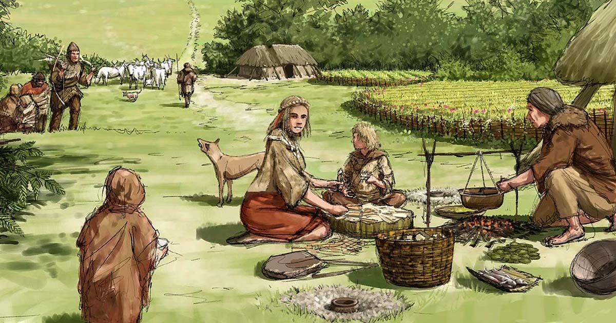
The thousand years of human presence on Menorca have come to be called the pre-Talayotic period. This term encompasses a culture that spans from the Neolithic until the Early Bronze Age, with an economy based on livestock and incipient agriculture. The most visible remains of this period are the megaliths (megalithic gravesites and naveta homes) and hypogea.

The denomination of "Talayotic" is related to one of the most typical elements of this culture, namely buil dings in the form of a tower and known by the island's inhabitants as "TALAYOT". From the 19th century to today, scientific bibliography has used this designation as a generic title for a wide area of insular prehistory. This does not exclude, as will be seen in the next sec tion, that under the heading CTMe (Talayotic Culture of Minorca) different phases or historical periods are presented.

What is the Talayotic Culture?

The Talaiotic Culture or Talaiotic Period is the name used to describe the society that existed on the Gymnesian Islands (the easternmost Balearic Islands) during the Iron Age. Its origins date from the end of the second millennium BC, when the inaccurately named Pre-Talaiotic Culture underwent a crisis and evolved into the Talaiotic Culture.

Up until the end of the 20th century, it was theorized that the Talaiotic Culture arose out of interaction between new peoples from the eastern Mediterranean and local island culture, in the form of an aggressive invasion, or perhaps as a peaceful assimilation. The Talaiotic Culture arose at the same time that the crisis caused by the Sea Peoples was occurring, which had revolutionized societies in this part of the Mediterranean until the 13th century BC. These theories were based mainly on architectonic remains that exist in abundance on Majorca and Menorca. The Talaiotic people were considered a warlike race due to the abundance of talaiots or defensive towers and the existence of walled towns. In addition, the talaiots were similar in many respects to the nuraghes of Sardinia, which lends credence to the theory that the Talaiotic people were of Sardinian origin.

However, archaeological excavations conducted at the end of the 20th and beginning of the 21st centuries have established that the talaiots were built much later –at the beginning of the first millennium BC, which means that they were not built during the time of the Sea Peoples and the Sardinian nuraghes. In addition, there is more and more proof that what was considered a sudden transition from a Pre-Talaiotic Culture during the Bronze Age to the Talaiotic Culture was actually a slow evolution lasting several centuries, and actually caused by a localized crisis on the Balearic Islands. However, external influences on the Talaiotic Culture cannot be completely discounted, since the existence of bronze alloys on the island (which requires tin, not available on the Balearic Islands) indicates that frequent contacts with the outside world existed.

The very factors that gave rise to the Talaiotic Period spelled its doom. Construction of talaiots ceased, and many of them were destroyed or converted for different uses. The nearby Punic center of Ebusus, present-day Ibiza, increased its commercial influence to include the Gymnesian Islands; this economic extension in effect transformed itself into an actual Punic colonization of the Gymnesian Islands. The Mediterranean subsequently became dominated by the Roman and Carthaginian Empires. The Punic Wars would erupt between these two powers, and the islands of Mallorca and Menorca would be forcibly dragged into what is called the Post-Talaiotic Period (also known as the Balearic Culture or Post-Talaiotic Culture).

List of Archaeological sites in Menorca

It should be pointed out too that Minorca was declared a Biosphere Reserve by UNESCO in 1993. The Prehistory of Minorca includes a long chronological period that starts with the arrival of man and ends with the Roman conquest that occurred in 123 B.C. The discovery of the Lithic industry of Binimel. Ià signals a pre-neolithic occupation up to 6000 B.C.. However, scientific data that corroborate the presence of permanent human communities, must be situated between 2500 and 2100 B.C., thanks to radiocarbon dating carried out on the remains from the tombs of Biniai Nou. These were communities between the Chalcolithic and the Initial Bronze, who established themselves in the main ecological niches and the most fertile areas of the island.

This Serial Property, representative of the CTMe, is made up of 25 archaeological sites. These were chosen for a series of reasons, such as their good state of conservation and the carrying out of archaeological research on them, etc. The main reason they were chosen though is because amongst all of the buildings chosen, each one of the architectural elements typical and serialized of the Talayotic Culture were represented, including the precedents.

It should also be highlighted that the idiosyncrasy of each one of them makes them a Serial Property of Outstanding Universal Value. Their characteristics, both in the construction technique used, the cyclopean in dry-stone, without mortar and the resulting form of each one of the Real Estate Assets, give them this characteristic of being megaliths of great Singularity and Uniqueness within World Heritage.

The Serial Property listed, firstly in chronological order and secondly according to their geographic proximity, are the following:

1. Tomb of Ses Roques Llises and the enclosure of Sa Comerma de se Garita

The tomb is a construction with a central chamber de limited by some large orthostats. Access is indicated by an "oradada" stone in its centre. The Sa Comerma enclosure is a monumental building with a patio in front of its façade. It is made up of numerous "Mediterranean" type columns that supported the stone slab roof. Three access doors with lintels have been identified.

2. Naviform settlement of Son Mercer de Baix

A settlement made up of a series of dwelling buil dings known also as "dwelling navetas" because of their floor plan shape. One stands out because of the conservation of its roof, supported by polylythical columns.

3. Hypogeum of Torre del Ram

A funereal hypogeum of an extended ground plan excavated in the rock. Within the interior there are continuous Stone benches around the walls and an access corridor.

4. Necropolis and Coastal Establishment of Cala Morell

A necropolis of artificial caves cut into the cliff walls. One stands out for its façade decorated with classic architectural motifs. On the upper part of the sea cliff there is a settlement of Naviforms, identified as a Coastal Establishment.

5. Navetas of Biniac-l'Argentina

Two funereal buildings of a circular ground plan. These types of buildings were always located away from the settlements. A large number of dead from the community were buried there, together with their belongings.

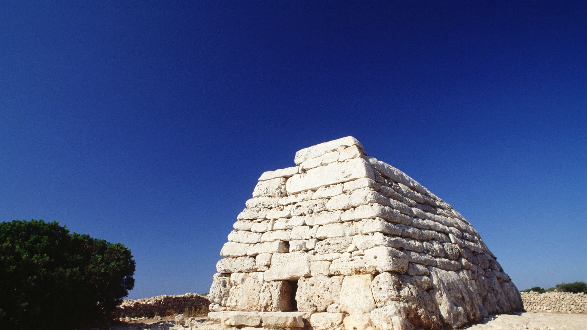
6. Naveta of Es Tudons

A funereal building with an extended ground plan in the shape of an upturned boat, with two interior cham bers that are accessed via a small door and a narrow corridor.

07. Navetas of Rafal Rubi

Two funeral buildings of an extended ground plan in the shape of upturned boats. They are situated at only 65m. apart, similar to those of Es Tudons.

8. Cave of s'Aigua

A prehistoric cave with an interior lake in which archaeological material has been found, such as cera mics and human remains.

9. Necropolis of Calescoves

This is the most extensive on the island. It is made up of a large quantity of natural caves and funeral hypogeums of different morphologies, all excavated in the walls of the cliffs that make up his cove. It was a necropolis from the 9th century B.C. to the 3rd century B.C. In this same enclosure, a sanctuary was identified that was in use from the 3rd century B.C. Also identified was a coastal establishment made up of walls that close off the promontory. This gave access to the cove, forming a quadrangular enclosure in which interior one finds a well with access steps. This small natural harbor of Calescoves was used for anchorage from the 5th century B.C.

10. Hypostyle Hall of Galliner de Madona

An enclosure covered by five polylythical columns whose function must be associated with storage use.

11. Talayot of Trebalyger

One of the larger talayots of the island. It has an ellip tical ground plan, built on and taking advantage of the height of a rocky promontory.

12. Talayots of Binicodrell

Two talayots, one with a ramp that gives access to a platform that is to be found in the upper part of the talayot.

13. Settlement of Torralba d'en Salort and the Well of Na Patarrá

A talayotic settlement that has an outstanding mo numental talayot as well as a Taula Enclosure with a central pilaster. This is the most monumental "Taula" of the island. Close to the enclosure and within the settlement itself there is a spectacular well known as Na Patarrá. This has a depth of 47 metres and has stairs that reach the aquifer.

14. Settlement of CorniaNou

A talayotic settlement in which a monumental talayot stands out with steps that give access to a platform located at the Crown of this tower and to a collection of semi-detached romos. At some 150 metres from the former, another talayotic type building has been identified. This is really the access point of the sett lement. There is a reinforced door that makes up a spectacular passageway in the interior.

15. Settlement and Naveta of sa Torreta de Tramun tana

This is a settlement made up of a Talayot, houses known as dwelling circles and a taula enclosure. It is one of the few settlements in the northern part of the island in which peaty soil predominates as opposed to calcareous stone. Close to the settlement there is a Naveta, a funeral building, of which only the floor remains.

16. Settlement of Talatí de Dalt

A Talayotic settlement with different structures, such as a monumental Talayot and a Taula Enclosure with an inclined column that is supported on the capital of the central piece. Outstanding is the entrance door to the settlement that is in a part of the face of the walls that can be seen. One can also see the series of hypostyle halls and covered enclosures. Parts of them were excavated and form an almost labyrinthine building complex.

17. Settlement of Torelló

A settlement in which a large Talayot stands out, on whose upper platform is conserved an entrance with lintels and a corridor. Just a few metres from this Talayot is another smaller one. Parts of the settle ments houses were excavated decades ago. They are typical in structure with a central patio and rooms around it, forming an almost circular building.

18. Settlement of Trepucó

A large Talayotic settlement that houses two Tala yots, the smaller of which has a covered chamber in the form of a false dome made roughly by courses. Various dwellings have been investigated, all of them circular. Its spectacular Taula Enclosure stands out, as well as the series of buildings that are close to it.

19. Settlement of Torre d'en Galmés

A large settlement that exceeds 6 hectares, made up of three Talayots located in the central part of the settlement, on the highest point with a great visual command over the coast, a Taula Enclosure and plen ty of dwellings with a circular ground plan, all of which are notably large. They have a central patio, storage silos, covered enclosures (also known as Hypostyle Halls) attached to them and, in certain cases, such as the dwelling known as "Circulo Cartailhac", they have a large open-air area in front of their façades. Here an oven has been indentified, as well as other areas of handicraft activity. In the southern part of the settle ment and at a lower height than that of the central part, a sophisticated water-collection system has been identified, with decanting pans and cisterns excavated into the rock-like wells.

20. Sanctuary of So na Caçana

A settlement made up of 10 buildings that include Ta layots and Taula Enclosures. Three of the latter have been identified and this confers on the archaeological site the status of more than a mere settlement-rather, it is a sacred place, a sanctuary.

21. Settlement of Montefí

A Talayotic settlement with three Talayots, under ground burial caves and an area of silos, stores and channels.

22. Settlement of Son Catlar

A large Talayotic settlement that has outstanding mo numental walls whose perimeter reaches 900 metres in length. Above the walls sentry boxes and square towers have been identified that are semi-detached to the walls. Its Taula Enclosure, Talayots and Dwellings etc., have all been conserved.

23. Settlement of Torre trencada

A Talayotic Settlement that stands out for having wi thin its Taula Enclosure, a Taula with a pilaster leaning on its rear part.

24. Settlement of Torrellafuda

A Talayotic Settlement with a large Talayot, a Taula Enclosure with a monumental central piece and with other such pieces within the same enclosure. Part of the face of the walls are identified and its natural surroundings are especially outstanding.

25. Settlement of Binisafullet

A Talayotic Settlement in which one can see a Talayot and a small Taula Enclosure as well as other dwelling buildings.

Gold coin hoard worth $300K found beneath kitchen floor in England

Homeowners in the United Kingdom discovered a stash of gold coins hidden beneath the wood floorboards of their kitchen during a renovation.

The cache includes more than 260 gold coins dating to between 1610 and 1727. (Image credit: Courtesy Spink & Son)

The cache, which is estimated to be valued at around $290,000 (250,000 pounds) at auction, is believed to be one of the largest hoards of 17th- and 18th-century English gold coins ever found in Britain and includes more than 260 gold coins dating to between 1610 and 1727, according to CNN(opens in new tab).

The discovery occurred in 2019, when contractors unearthed a salt-glazed earthenware cup, similar in size to a soda can, as they pried up the floorboards during the renovation project at the 18th-century home, located in Ellerby, a village in North Yorkshire. 

Upon further inspection, the workers found some of the coins rattling inside the cup, which consisted mainly of 50- and 100-pound coins "that were used at the time," as well as a Brazilian coin that circulated in England during the 1720s, according to a statement from Spink & Son, a London-based auction house.

"It is a wonderful and truly unexpected discovery from so unassuming a find location," Gregory Edmund, an auctioneer with Spink & Son, told CNN.

The coins likely belonged to Joseph and Sarah Fernley-Maisters, members of an influential mercantile family that included several members of Parliament who lived in the area during the late 1600s and early 1700s, according to the statement.

"Joseph and Sarah clearly distrusted the newly formed Bank of England, the 'banknote' and even the gold coinage of their day because they [chose] to hold onto so many coins dating to the English Civil War and beforehand," Edmund said in the statement. "Why they never recovered the coins when they were really easy to find just beneath original 18th-century floorboards is an even bigger mystery, but it is one hell of a piggy bank."

Next month, the treasure trove will go up for auction through Spink & Son and is expected to fetch nearly $300,000.

Source: https://www.livescience.com/gold-coins-dis...

How did the Vikings navigate?

Long before a compass or naval maps were used in Europe, the Vikings set about sailing the high seas from modern-day Canada to Constantinople. 

Vikings were skilled sailors and navigators. Source: vlastas / Shutterstock

Their famous longships ferried them across meandering rivers, stormy seas, and expansive oceans, making them skilled sailors. Yet, without the aid of sophisticated naval technology, how did the Vikings navigate across such vast distances?

Water, water everywhere…

Deep love and knowledge of sailing are embedded into the fabric of modern Scandinavian societies. In Norway, for example, a nation of just over 5 million people, there is estimated to be over 1 million boats. So, where did this passion arise? One look at Scandinavia today, and you'll notice it is indeed girt by vast sums of water.

All the Nordic (Norway, Sweden, Finland, Iceland, Denmark, and Greenland) countries – where Viking societies were present during the early medieval period – are located in the northeast quadrant of the Atlantic Ocean. Zooming in further, there are a plethora of seas. These countries have the waters of the Baltic, the Barents, the Greenland, the Kattegat, the North, the Norwegian, and the Skagerrak seas wash up on their shores whilst having the frosty Arctic Ocean as a northern border.

The Vikings' skillful exploitation of nautical technology enabled them to raid, trade, and colonize throughout the Western Hemisphere and into North Africa and West Asia. Being surrounded by vast oceans and seas, it should be no surprise that the most iconic symbol of the Vikings is, after all, a ship.

Vikings possessed a wealth of rudimentary maritime navigation skills and knowledge

In an era before the compass had arrived in Europe, before maps were widespread and satellite navigation was a millennium away, the Vikings sailed vast distances between Northern and Southern Europe, throughout the Mediterranean Sea, through the vast and numerous river systems of Eastern Europe and the Russian steppe and across the North Atlantic Ocean. 

They did, however, have some rudimentary navigational knowledge. Their knowledge of direction – North, South, East, and West – came from the daily cycle of the sun. Yet the principle underpinning much of their navigational skills was the exact location on the horizon where the sun rose and how high it reached during the day.

Sailors from Viking societies also used other natural landmarks when taking to the high seas. The sun, the moon, and the stars also provided an understanding of the direction to travel. However, the often-inclement weather found in the North Atlantic Ocean hampered this. 

Hugging coastal areas and looking for specific landmarks – rocks, bays, or a hilltop – could aid navigation. This sort of coastal hugging and landmark spotting is best described in the discovery of 'Vinland' in Grælendinga saga (Saga of the Greenlanders). Here, Leif Eriksson followed the past directions of a previous lost voyage to Greenland that ended up in 'Vinland' – what is now believed to be Newfoundland, Canada. Eriksson hugged the shore until he found a bay that was accessible in which the Norse explorers went ashore to explore this strange new world.

Sun crystals - kooky pseudo-science or a historical fact?

A new and emerging theory in Norse studies – first proposed in 1967 by Danish archaeologist Thorkild Ramskou – was that Viking sailors used chunks of crystal, called sunstones, to track the sun on a cloudy day. However, there is some actual science – and not pseudo-science – behind the proposed use of crystals for navigation.

The use of a crystal to find the sun on a cloudy day relies on the 'polarization' of the sun. This means that the light had a specific orientation. When then sunlight travels through the atmosphere, it forms polarized rings. These rings are only visible for animals and fish as the human eye is unable to detect them. However, with the use of crystals, like calcite, the direction of polarization, even on a cloudy day, can be revealed. When the sunstone is at its brightest, the crystal will point at the sun, allowing some form of rudimentary navigation, even on a grey, wet, and miserable foggy day in the North Sea.

These sun crystals were often mentioned in stories and sagas. One such instance was the reference to a sólarsteinn (a solar stone, a sunstone) in The Saga of King Olav. Yet the only archaeological evidence of the use of solar stones was from almost half a millennium later. In 2013 a British team discovered a ship that had been sunk in 1592 – 500 years after the end of the 'Viking Age.' Amongst the items were shards of a crystal, an Iceland spar (calcite), that was believed to have been used as a sunstone.

The answer is right in front of your nose - and animal friends

Vikings also used their other senses to navigate the oceans, seas, and rivers across much of the Western hemisphere and beyond. Listening for birds and the crashing of waves on the shore was one way to figure out how close they were to land on a foggy day. The direction of a sea breeze could also be used to navigate as well as to determine whether any fresh water, from the land, had flowed around them. Finally, an experienced sailor can smell signs of land life – fires, trees, and even some plants – given suitable conditions.

Animals were also helpful friends when it came to maritime navigation. Spotting certain birds meant land was near as particular breeds only flew close to the shore. Whales usually stayed close to currents where plentiful fish could be found. The Vikings knew of the migratory habits of many whales and could use this to help find particular areas of oceans or seas.

Viking sailors masterfully employed all this knowledge, skill, and expertise, whether they were raiding, trading, or exploring the oceans around the Scandinavian peninsula and beyond. Surely they rate as some of the medieval era's best maritime navigators… after all, they "discovered" America half a millennium before Columbus…

The Royal Society published a study in 2018 looking at the Viking's use of solar stones and polarization. You can find it here.

Source: https://thevikingherald.com/article/how-di...

In Germany's 'Stonehenge', A Discovery Sheds Light On 4,000-Year-Old Beer Making

An ancient brewery dating back to more than 4,000 years ago has been unearthed in German 'Stonehenge'.

Excavations have been going on at the site for the last five years. (Representational Photo)

An ancient brewery dating back to more than 4,000 years ago has been unearthed in German 'Stonehenge', a site resembling the original one in the UK with its concentric circles and wooden or stone structures, Newsweek said in a report. The discovery took place earlier this month at the Ring Sanctuary of Poemmelte in the Salzland region of the state of Saxony-Anhalt, and is believed to be central Germany's first brewery, the outlet further said in its report.

Excavations have been going on at the site for the last five years and more than 10,000 discoveries have been made. It will be complete in September 2022.

"The remains of a special drying oven still contain grain residues, from which malt was possibly obtained for an early form of beer production," Dr Franziska Knoll, from the State Office for Monument Preservation and Archaeology of Saxony-Anhalt, was quoted as saying by Newsweek.

"To be absolutely sure, we still have to wait for the archaeobotanical analysis," she added.

But the barley and malt obtained from the excavation site gave another German professor, 62-year-old Harald Meller, confidence that people who descended from eastern Barbarians (around 2,400 BC) had nearly perfected the art of making ale.

"It is quite possible that we will come across the first mug from which the beer was served," Professor Meller was quoted as saying by the outlet.

Dr Gunnar Schellenberger, the president of the State Parliament of Saxony-Anhalt, welcomed the discovery, saying it will help develop interest about the region in tourists.

The Ring Sanctuary, located over 130 kilometres from Germany's capital Berlin, was reconstructed in 2016 and since then has become a popular tourist attraction.

Source: https://www.ndtv.com/world-news/in-germany...

New DNA analysis shed light to Indo-European homeland

Credit: PeopleOfAr


BY THE ARCHAEOLOGIST EDITOR GROUP


Detailed paleogenetic research sheds light on Southern Arc migration, farming, and language evolution.

In a trio of papers, published simultaneously in the journal Science, Ron Pinhasi from the Department of Evolutionary Anthropology and Human Evolution and Archaeological Sciences (HEAS) at the University of Vienna and Songül Alpaslan-Roodenberg from the University of Vienna and Harvard University, Iosif Lazaridis and David Reich at Harvard University—together with 202 co-authors—report a massive effort of genome-wide sequencing from 727 distinct ancient individuals with which it was possible to test longstanding archaeological, genetic and linguistic hypotheses. They present a systematic picture of the interlinked histories of peoples across the Southern Arc Region from the origins of agriculture, to late medieval times.

Credit: University of Vienna

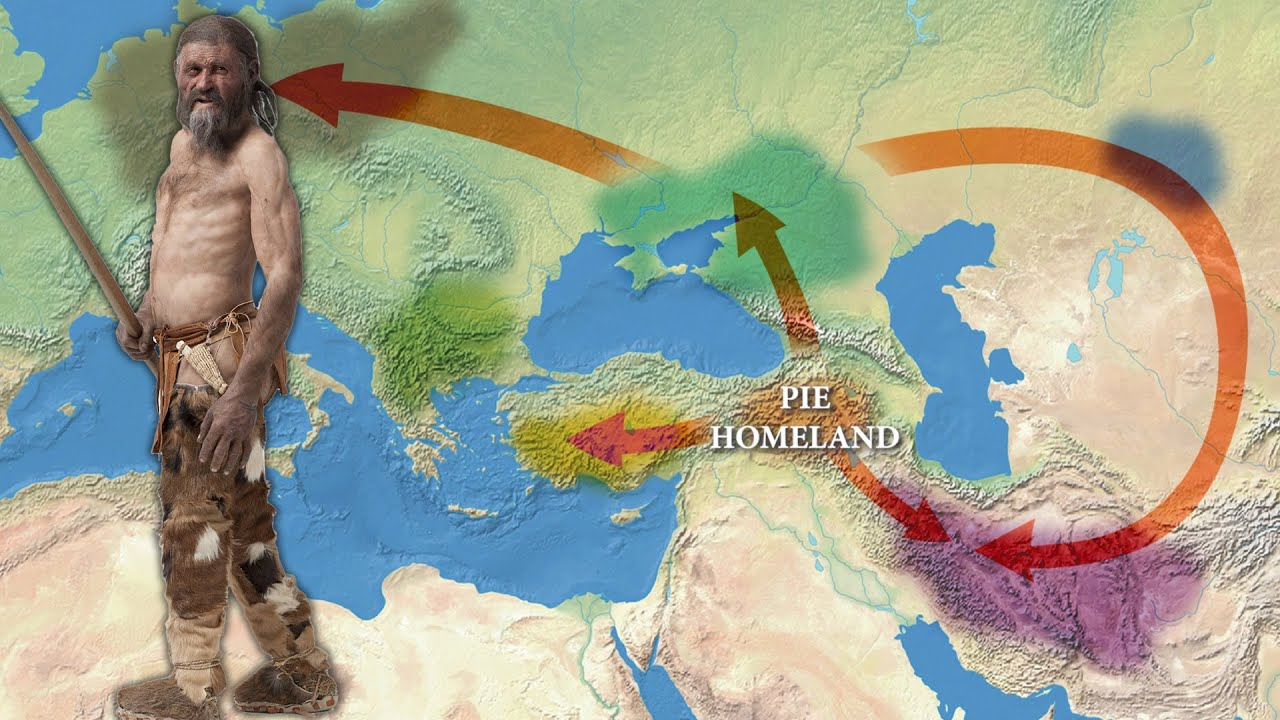
The first article by the international team looked at the origins and dissemination of Indo-European and Anatolian languages. The Indo-Anatolian language family's ancestral home is thought to have been in West Asia, according to genetic evidence, with secondary dispersals of non-Anatolian Indo-Europeans from the Eurasian steppe. People with Caucasian origin came into Anatolia in the west and the steppe in the north during the first stage, which took place between 7,000 and 5,000 years ago. These people may have spoken Anatolian and Indo-European languages in their ancestry.

Around 5,000 years ago, Yamnaya steppe herders with Caucasus hunter-gatherer and Eastern hunter-gatherer heritage set off a series of migrations across Eurasia that may be traced to all currently spoken Indo-European languages (such as Greek, Armenian, and Sanskrit). Their southern excursions into the Balkans and Greece, as well as their eastern expansions across the Caucasus into Armenia, left a mark on the region's Bronze Age inhabitants.

The Yamnaya herders' descendants mixed differently with the local people as they grew. Several types of genetic evidence can be used to pinpoint how Indo-European-speaking immigrants from the steppe interacted with locals to create the Greek, Paleo-Balkan, and Albanian (Indo-European) languages in Southeastern Europe and the Armenian language in West Asia. The Yamnaya had a significant influence on Southeastern Europe, as individuals with nearly pure Yamnaya heritage arrived shortly after the Yamnaya migrations began.

The Southern Arc's Anatolia core region, where large-scale data offers a rich picture of change—and lack of change—over time, yields some of the most startling findings. According to the findings, Anatolia was not significantly affected by the Yamnaya migrations, in contrast to the Balkans and the Caucasus. Due to the absence of Eastern hunter-gatherer ancestors in Anatolia, in contrast to all other places where Indo-European languages were spoken, no connection to the steppe can be established for speakers of Anatolian languages (such as Hittite and Luwian).

The southern Caucasus was impacted numerous times, even before the Yamnaya migrations, in contrast to Anatolia's startling impermeability to steppe migrations. "I was surprised to learn that the Areni Chalcolithic people, who were discovered 15 years ago in the excavation I co-led, had ancestry from gene flow from the north to areas of the southern Caucasus more than 1,000 years before the Yamnaya expanded, and that this northern influence would disappear in the area before reappearing a few thousand years later. This demonstrates that there is still a lot of information to be learned through new digs and fieldwork in Eastern Western Asia "Ron Pinhasi says.

"Anatolia was home to varied communities descending from both local hunter-gatherers and eastern populations of the Caucasus, Mesopotamia, and the Levant," states Songül Alpaslan-Roodenberg

"Variations of the same types of ancestry were shared by the inhabitants of the Marmara region, Southeastern Anatolia, the Black Sea, and the Aegean regions."

Credit: University of Vienna

The interconnections of the first farming societies

The second research project investigates the origins of the world's oldest Neolithic populations, which date to around 12,000 years ago. "The genetic findings support the idea that early farming groups had a network of pan-regional relationships. In addition, they offer fresh proof that the Neolithic transition was a difficult process that took place not just in one central region but also in Anatolia and the Near East, "Ron Pinhasi said.

It gives the first ancient DNA data for Pre-Pottery Neolithic farmers from the Tigris side of northern Mesopotamia, which is a critical region for the origins of agriculture and can be found in both eastern Turkey and northern Iraq. The island of Cyprus, which saw the earliest maritime migration of farmers from the eastern Mediterranean, also contains the first ancient DNA from Pre-Pottery farmers. Together with the first information from Neolithic Armenia, it also offers fresh information on early Neolithic farmers from the Northwest Zagros.

By filling in these gaps, the authors were able to examine the genetic history of these societies, for which archaeological research had previously documented intricate economic and cultural interactions but was unable to track mating practices or interactions that did not leave visible material traces. The findings demonstrate pre-Neolithic roots from hunter-gatherers in the Caucasus, Levant, and Anatolia, and they demonstrate that these early farming cultures created a continuity of lineage that mirrored the topography of West Asia. The findings also show at least two waves of migration from the Fertile Crescent's core to Anatolia's ancient farmers.

The historic period

The third piece demonstrates how ancient Mediterranean political systems maintained differences in lineage from the Bronze Age while remaining connected by migration. The findings indicate that while Italians before the Imperial period had a totally diverse distribution, the ancestry of those who resided in and around Rome during the Imperial period was nearly identical to that of Roman and Byzantine inhabitants from Anatolia. This shows that the heterogeneous but comparable population of the Roman Empire, both in its longer-lasting eastern component focused on Anatolia and in its shorter-lasting western part, was plausible drawn to a significant extent from Anatolian pre-Imperial sources.

"Our findings are rather unexpected considering that in a Science study I co-authored in 2019 on the genetic heritage of people from Ancient Rome, we discovered a cosmopolitan pattern that we initially believed to be specific to Rome. Now that we can see it, other parts of the Roman Empire were just as multicultural as Rome itself, "Ron Pinhasi argues.

Iceland’s ancient caves reveal the island’s Viking early history

‘My grandfather told me the history of the caves that his grandfather told him,’ Baldur Thorhallsson said. ‘Tourists love those stories as well’

Gustaf Skarsgard as Floki in the TV series Vikings, in front of a waterfall in Iceland where the show was filmed. The enduring fascinating with Viking history is a boon to Iceland’s tourist industry (Photo: Arnaldur Halldarsson/History)

South Iceland is home to some of the country’s most jaw-dropping scenery – wondrous waterfalls, vast glaciers and sweeping black sand beaches. But the region is also full of Viking history, including recently discovered ruins dating from the 10th century.

Vikings from Scandinavia and the British Isles descended on Iceland in the ninth century, enduring volcanic eruptions, harsh winters and famine. Iceland’s early settlers built extensive cave systems to survive, some of which are just now seeing the light of day after centuries buried in the earth.

Excavations of man-made, Viking-era caves near Oddi in the country’s south have revealed an extensive system of interconnected structures much larger and older than initially thought. Archaeologists say the excavations show that the caves at Oddi were first dug out in the middle of the 10th century.

Excavations of caves in Iceland have provided new insight into the remote island’s early history (Photo: Supplied)

Kristborg Þórsdóttir, of the Archaeological Institute of Iceland who is leading the excavation, said one of the best known clan members was Sæmundur fróði (Sæmundur the Learned) who lived from 1056 to 1133 .
A key figure in Icelandic folklore, the scholar and priest founded the school at Oddi and was known as the most educated man in Iceland.

“He was sent to central Europe to study, and when he returned, he became a prominent figure in society and is believed to have written some of the earliest literary works in Iceland,” she said.

He also came to be mythologised as a man who managed to trick the devil. In one story, he was at a school for the black arts, where the devil had the right to take the last student of each group. But when Sæmundur trailed behind his companions and the devil went to seize him, he said, “I am not the last. Do you not see who follows me?” He pointed at his shadow which the devil tried to snatch, allowing Sæmundur to flee.

In addition to becoming the centre of Viking power and influence, Oddi was also a hotspot for culture and learning. The writer Snorri Sturluson was fostered there by Jón Loftsson (Sæmundur’s grandson). Sturluson (1179-1241AD) was one of the most significant figures in Iceland’s history: a chieftain, storyteller, politician and literary figure, credited with many of Iceland’s most important literary works of the Middle Ages, including Egil’s Saga.

Ms Þórsdóttir said the Oddi excavations have revealed the oldest dated example of a man-made cave in Iceland. They have been dated by aligning the layers of ash and volcanic debris with the known dates of eruptions.

“The fact that the cave in Oddi seems to have been dug out in the 10th century makes it a Viking age structure, adding to our previous knowledge of the building techniques of the first settlers in Iceland and of the people of the North Atlantic,” she said.

“Our research shows that the making and use of man-made caves in Iceland was widespread and started earlier than was previously known. From our experience in Oddi, [we believe] there are many structures of this type that have been sealed off and forgotten.

“We hope to be able to continue the excavation to get a better idea of how long these caves were in use, how their use changed over time and if there are any indications of people living in parts of the cave system,” she said.

Among the discoveries is a cave that may have been used to protect cattle and horses. Such stalls were known as nautahellirs and feature in the 13th century book Legends of Saints by Bishop Þorlákur, in which a cave collapse was recorded.

Collapses are also a risk for archaeologists. The caves are cut into sandstone which absorbs water and is prone to crumbling.

Discoveries in the caves bring new context to saga stories and oral history passed down in the country (Photo: Supplied)

But the find is expected to become a major tourist drawcard.

The country has numerous other Viking-era sites that range from the historic to the kitschy. The Caves of Hella on the south coast is a popular attraction and the site of 12 man-made caves. Four were opened to the public in 2019, and the site is one of Iceland’s oldest standing archaeological remains.

Elsewhere, the Skógar Museum features many Viking artefacts, and Skyrland introduces visitors to the 1,000-year-old story of how a Viking dairy product (skyr) became a global health food. Nearby, Ingólfsskáli restaurant gives travellers the chance to experience Viking feasts with a contemporary touch.

Locals are optimistic that the discovery could cement Oddi’s place in the history books. Baldur Thorhallsson, whose family has been taking care of the Caves of Hella for nearly 200 years, said it was a positive development.

“I’m a teacher, and I know that Icelanders love to hear a good story and caves are a great story,” said Mr Thorhallsson.

“My grandfather told me the history of the caves in Hella that his grandfather told him. Tourists love those stories as well.”

Source: https://inews.co.uk/news/world/iceland-anc...