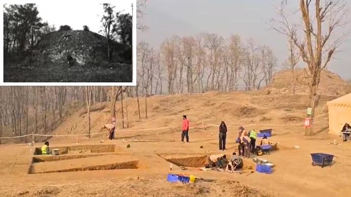
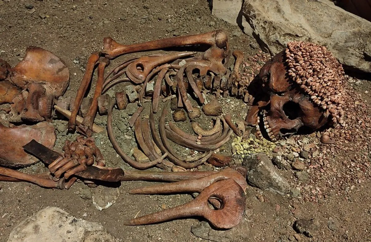
Throughout history, human beings have created remarkable structures that have withstood the test of time. These ancient buildings provide a glimpse into the early ingenuity, architectural skills, and cultural practices of our ancestors. Below is an exploration of some of the oldest buildings in the world, highlighting their historical significance and the fascinating stories behind them.
Asia
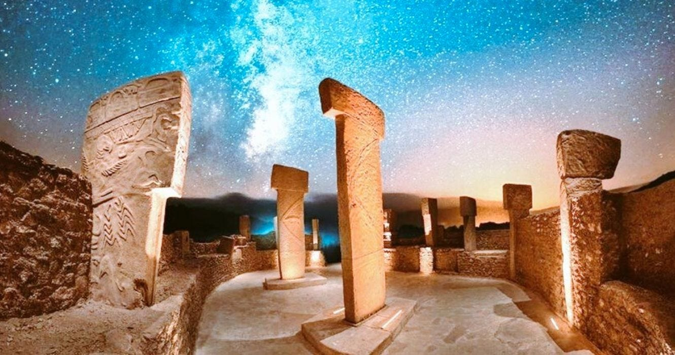
Göbekli Tepe, Turkey: 9500-7500 BC, place of worship.
Göbekli Tepe, located in the southeastern region of Turkey near the city of Şanlıurfa, is considered one of the most important archaeological discoveries of the 20th century. Dating back to approximately 9500-7500 BC, this site is the world's oldest known temple complex and significantly predates other famous ancient structures such as Stonehenge and the Egyptian pyramids.
Discovery and Excavation
Göbekli Tepe was first identified in the 1960s by a survey conducted by Istanbul University and the University of Chicago, but it was not until 1994 that German archaeologist Klaus Schmidt began extensive excavations at the site. Schmidt's work uncovered massive stone pillars arranged in circular formations, along with intricately carved reliefs depicting various animals and abstract symbols.
Architecture and Features
The architecture of Göbekli Tepe is remarkable for its complexity and scale. The site consists of several large circular and oval structures, each built from massive limestone pillars that stand up to 6 meters (20 feet) high and weigh several tons. These pillars are arranged in a series of rings, with some connected by stone walls. The central pillars in each ring are often larger and more elaborately decorated than the peripheral ones.
The carvings on the pillars include depictions of animals such as lions, snakes, foxes, and birds, as well as abstract symbols. These carvings are considered some of the earliest examples of symbolic art and indicate a rich symbolic and possibly ritualistic culture.
Function and Significance
Göbekli Tepe is believed to have been a site for religious or ceremonial activities, given its monumental scale and the absence of evidence for permanent habitation. It is thought that hunter-gatherer groups from the surrounding regions gathered at Göbekli Tepe for communal and ritualistic purposes.
The site's significance extends beyond its age and architectural complexity; it challenges previous assumptions about the development of human society. The construction of such a monumental complex by pre-agricultural societies suggests that the desire for communal religious activities may have played a significant role in the development of settled communities and the advent of agriculture.
Impact on Archaeological Understanding
Göbekli Tepe has reshaped our understanding of prehistoric human societies. Its discovery suggests that complex religious practices and social organization existed long before the advent of agriculture and settled life. This challenges the traditional view that organized religion and large-scale construction projects arose only after the establishment of agricultural societies.
Additionally, Göbekli Tepe has provided invaluable insights into the symbolic and cultural life of early humans, highlighting the importance of spiritual and communal activities in shaping human history.
Preservation and Tourism
Today, Göbekli Tepe is a UNESCO World Heritage Site and has become a significant attraction for tourists and researchers alike. Efforts are ongoing to preserve the site while allowing for continued archaeological exploration. The Turkish government, in collaboration with international organizations, has implemented measures to protect the site from environmental and human-induced damage.
Göbekli Tepe stands as a testament to the ingenuity and spiritual life of early human societies. Its discovery continues to inspire and challenge our understanding of prehistoric cultures, emphasizing the profound impact of religious and communal practices on the development of human civilization.
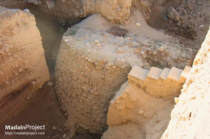
Tower of Jericho, West Bank, Palestine: 8000 BC, tower.
The Tower of Jericho is one of the earliest known monumental structures in human history, dating back to around 8000 BC. Located in the ancient city of Jericho, situated in the West Bank, Palestine, this tower is part of a larger archaeological site that provides invaluable insights into early human settlement and urban development.
Discovery and Excavation
The Tower of Jericho was discovered during excavations led by British archaeologist Kathleen Kenyon in the 1950s. Jericho is one of the oldest continuously inhabited cities in the world, and the site has been a focal point for archaeological studies due to its deep historical significance. Kenyon's work revealed the tower, along with other significant structures, buried beneath layers of sediment accumulated over millennia.
Architecture and Features
The Tower of Jericho is an impressive stone structure standing approximately 8.5 meters (28 feet) high. It is constructed from undressed stones, meaning the stones were used in their natural form without being shaped or polished. The tower has a conical shape and includes an internal staircase with twenty-two steps, which spirals around the interior of the structure.
The base of the tower measures about 9 meters (30 feet) in diameter, and it narrows as it ascends. The stones used in its construction vary in size, with the largest stones forming the foundation. The internal staircase is an architectural feat, providing access to the top of the tower, which would have offered a vantage point over the surrounding landscape.
Function and Significance
The purpose of the Tower of Jericho remains a subject of debate among archaeologists. Several theories have been proposed regarding its function:
Defense: One prevalent theory is that the tower served a defensive purpose. It could have been part of a larger fortification system designed to protect the settlement from external threats, such as rival groups or wild animals.
Flood Control: Another theory suggests that the tower and associated structures might have been part of a flood control system. The nearby Jordan River and the frequent flooding in the area could have necessitated such measures.
Religious or Ceremonial: Some researchers propose that the tower had a religious or ceremonial function. Its construction might have been related to early spiritual practices, serving as a communal gathering place for rituals and ceremonies.
Social Cohesion: Building such a monumental structure would have required coordinated effort and resources, possibly serving to strengthen social bonds within the community and establish a sense of shared purpose and identity.
Historical Context
The Tower of Jericho is situated within a Neolithic settlement that showcases some of the earliest examples of urban planning and communal living. The broader site of Jericho includes other notable features such as walls, houses, and storage facilities, indicating a complex and organized society.
Jericho's location near the Jordan River made it a strategic and resource-rich area, conducive to early human settlement. The presence of the tower, along with other structures, suggests that the inhabitants had developed advanced construction techniques and a degree of social organization that facilitated large-scale building projects.
Impact on Archaeological Understanding
The discovery of the Tower of Jericho has profound implications for our understanding of early human societies. It challenges the notion that monumental architecture and complex urban planning emerged only with the advent of agriculture and later civilizations. Instead, it suggests that even early hunter-gatherer communities had the capability to organize and execute large construction projects.
The tower also provides insights into the technological and engineering skills of early humans, highlighting their ability to manipulate natural materials and create enduring structures.
Preservation and Tourism
Today, the Tower of Jericho is part of a significant archaeological site that attracts researchers and tourists from around the world. Efforts are made to preserve the ancient ruins while allowing for continued archaeological exploration and study. The site offers a tangible connection to our distant past and serves as a testament to the ingenuity and resilience of early human communities.
The Tower of Jericho stands as a remarkable monument to the early ingenuity and architectural prowess of prehistoric humans. Its discovery and subsequent studies provide a window into the complex social, religious, and practical lives of one of the earliest known urban settlements. As one of the oldest towers in the world, it continues to fascinate and inspire, offering valuable lessons about the origins of human civilization.
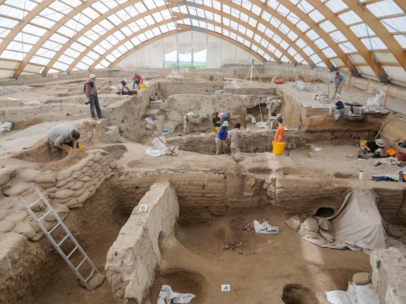
Çatalhöyük, Turkey: 7500-5700 BC, settlement.
Çatalhöyük is one of the most significant and best-preserved Neolithic settlements in the world, located in modern-day Turkey. It flourished between approximately 7500 and 5700 BC and provides valuable insights into early human society, architecture, and culture.
Location
Çatalhöyük is situated in the Konya Plain in south-central Turkey, near the modern town of Konya. The site consists of two mounds, the larger East Mound and the smaller West Mound, representing different phases of settlement.
Architecture
Houses: The settlement is renowned for its densely packed, mud-brick houses, which were constructed without streets or pathways. Instead, houses were accessed via ladders from the roofs, which also served as communal spaces.
Interiors: The interiors of houses were elaborately decorated with murals, reliefs, and sculptures. Many walls featured geometric designs, hunting scenes, and depictions of animals and humans.
Construction: Houses were built closely together, forming a continuous row of structures. Each house typically had a rectangular layout with a main living space and smaller side rooms.
Social Structure
Community: The lack of hierarchical structures, such as palaces or temples, suggests a relatively egalitarian society. Social organization appeared to be based on households rather than centralized authority.
Burials: Many burials were found beneath the floors of houses, often with grave goods, indicating a belief in an afterlife and the significance of ancestors.
Economy and Subsistence
Agriculture: The inhabitants of Çatalhöyük practiced early forms of agriculture, cultivating wheat, barley, and legumes. They also domesticated animals such as sheep, goats, and cattle.
Crafts: The site reveals evidence of advanced crafts, including pottery, weaving, and tool-making. Obsidian, sourced from nearby volcanic areas, was particularly important for making tools and trade.
Religion and Rituals
Shrines: Many houses contained areas that seem to have served religious or ritual purposes, featuring elaborate decorations, bull skulls (bucrania), and figurines.
Symbolism: Artifacts and wall paintings suggest a rich symbolic and ritual life, with recurring themes of fertility, death, and the natural world.
Discoveries and Excavations
Excavations: Çatalhöyük was first excavated by British archaeologist James Mellaart in the 1960s. Since 1993, ongoing excavations have been conducted by an international team led by Ian Hodder.
Findings: The excavations have uncovered thousands of artifacts, including tools, pottery, figurines, and wall paintings, providing a comprehensive picture of Neolithic life.
Significance
Historical Importance: Çatalhöyük offers a unique glimpse into early human settlement patterns, social structures, and cultural practices. It challenges traditional notions of early urban development and highlights the complexity of Neolithic societies.
UNESCO World Heritage Site: In 2012, Çatalhöyük was inscribed as a UNESCO World Heritage Site, recognizing its outstanding value to humanity.
Çatalhöyük continues to be a focal point for archaeological research and education, offering valuable lessons about the origins of settled life and early human societies.
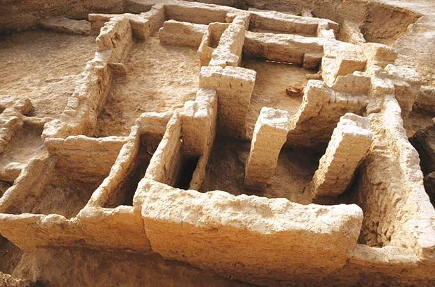
Mehrgarh, Pakistan: 7000 BC, settlement.
Mehrgarh is one of the most significant Neolithic sites in South Asia, providing invaluable insights into early human settlement and the development of agricultural practices. Located in the Kacchi Plain of Balochistan, Pakistan, Mehrgarh dates back to approximately 7000 BC. It is considered a precursor to the Indus Valley Civilization and one of the earliest centers of farming and herding in the region.
Discovery and Excavation
Mehrgarh was discovered in 1974 by the French archaeologist Jean-François Jarrige and his team. Extensive excavations have revealed a wealth of information about early human life, making Mehrgarh a key site for understanding the transition from nomadic hunter-gatherer lifestyles to settled agricultural communities.
Archaeological Findings
The site of Mehrgarh covers an area of about 250 hectares and has been excavated in several stages, revealing evidence of continuous human occupation over thousands of years. Key findings include:
Early Farming and Herding: Mehrgarh shows some of the earliest evidence of farming and herding in South Asia. The inhabitants cultivated barley and wheat and domesticated animals such as sheep, goats, and cattle. This shift to agriculture marked a significant transformation in human society, leading to more permanent settlements.
Mudbrick Structures: The early inhabitants of Mehrgarh lived in mudbrick houses. These structures indicate a level of architectural planning and community organization. The houses were often divided into rooms and included storage spaces for grains, suggesting advanced domestic arrangements.
Burials and Grave Goods: Excavations have uncovered several burial sites, providing insights into the spiritual and cultural practices of the Mehrgarh people. Many graves contained goods such as tools, ornaments, and pottery, indicating beliefs in an afterlife and the importance of ceremonial practices.
Pottery and Tools: Mehrgarh is notable for its early use of pottery, which evolved from simple handmade designs to more complex and decorated forms. The site also yielded a variety of stone and bone tools, showcasing the technological advancements of the period.
Dental Practices: One of the most remarkable discoveries at Mehrgarh is evidence of early dental practices. Researchers found drilled teeth in human remains dating back to around 7000 BC, indicating that the inhabitants had developed rudimentary forms of dentistry, possibly for therapeutic or ritualistic purposes.
Cultural and Historical Significance
Mehrgarh represents a crucial stage in the development of human civilization in South Asia. The site provides evidence of the early domestication of plants and animals, which laid the foundation for the rise of complex societies and urban centers in the region.
The cultural artifacts and architectural remains at Mehrgarh demonstrate a high degree of sophistication and innovation. The site's long period of occupation, spanning several millennia, offers a unique opportunity to study the evolution of human society from the Neolithic to the Bronze Age.
Influence on the Indus Valley Civilization
Mehrgarh is often considered a precursor to the Indus Valley Civilization, one of the world's earliest urban cultures. The practices and technologies developed at Mehrgarh, such as agriculture, pottery, and architecture, likely influenced the later cities of Harappa and Mohenjo-Daro. The continuity and advancements seen at Mehrgarh provide a direct link to the complex urban planning and social organization characteristic of the Indus Valley Civilization.
Preservation and Tourism
Today, Mehrgarh is recognized as a site of immense archaeological importance. Efforts are made to preserve the site and its artifacts, many of which are displayed in museums. Mehrgarh attracts researchers and tourists interested in the origins of human settlement and the development of early agricultural societies.
Mehrgarh stands as a testament to the ingenuity and adaptability of early human societies. Its discovery has significantly enhanced our understanding of the Neolithic period in South Asia and the processes that led to the development of complex civilizations. The site continues to provide valuable insights into the early domestication of plants and animals, the evolution of architecture, and the cultural practices of one of the world's earliest farming communities.
Tepe Sialk, Iran: 3000 BC, ziggurat.
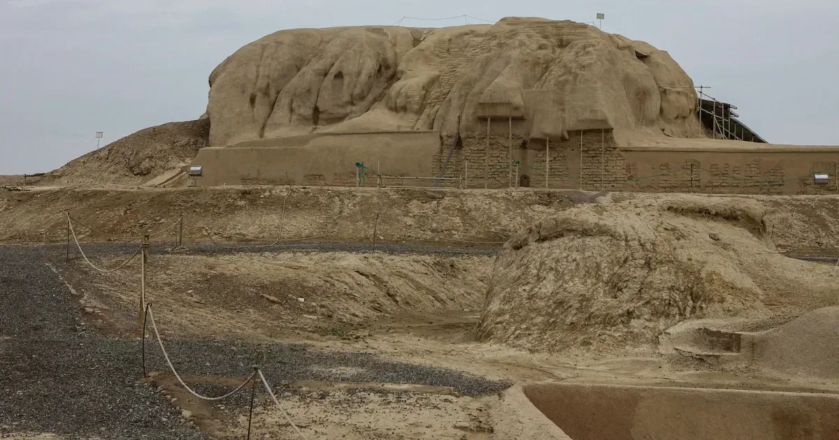
Tepe Sialk, located near the city of Kashan in central Iran, is one of the most important archaeological sites in the Near East. It features some of the earliest known ziggurats, dating back to around 3000 BC. The site provides significant insights into the early development of urbanization, architecture, and cultural practices in ancient Iran.
Discovery and Excavation
Tepe Sialk was first excavated in the 1930s by a team of French archaeologists led by Roman Ghirshman. Subsequent excavations have continued to uncover layers of occupation that span several millennia, revealing a complex history of human settlement and architectural evolution.
Architecture and Structure
Tepe Sialk consists of two main mounds, referred to as Sialk North and Sialk South, each containing multiple layers of occupation:
Sialk North: This mound contains the earliest layers, dating back to the Neolithic period (around 6000-5500 BC). The remains include primitive mudbrick houses, pottery, and evidence of early farming practices.
Sialk South: This mound is notable for its large ziggurat, dating to around 3000 BC. The ziggurat is a stepped pyramid structure made of mudbrick, characteristic of early Mesopotamian and Elamite architecture. It was likely used for religious and ceremonial purposes, serving as a platform for temples and other significant buildings.
Features of the Ziggurat
The ziggurat at Tepe Sialk is one of the earliest examples of such structures in the region. Key features include:
Stepped Design: The ziggurat is built in a stepped fashion, with each successive level smaller than the one below, creating a pyramid-like shape.
Mudbrick Construction: The structure is made entirely of sun-dried mudbricks, a common building material in ancient Iran due to the scarcity of stone.
Platform for Temples: The top of the ziggurat would have supported a temple or shrine, serving as a focal point for religious activities and possibly administrative functions.
Cultural and Historical Significance
Tepe Sialk is significant for several reasons:
Early Urbanization: The site provides evidence of early urban development, with complex social structures and organized community life.
Technological Advancements: The construction techniques used at Tepe Sialk, particularly in the ziggurat, reflect advanced knowledge of engineering and architecture.
Cultural Interactions: Artifacts found at the site, including pottery, tools, and decorative items, show connections with contemporary cultures in Mesopotamia and the Indus Valley, indicating early trade and cultural exchanges.
Archaeological Discoveries
Excavations at Tepe Sialk have uncovered a wealth of artifacts that offer insights into the daily life, economy, and religious practices of its inhabitants:
Pottery and Ceramics: The site has yielded a rich collection of pottery, ranging from simple utilitarian wares to elaborately decorated ceremonial pieces.
Tools and Implements: Stone and metal tools found at Tepe Sialk reveal a high degree of craftsmanship and technological sophistication.
Burial Practices: The discovery of burial sites, with grave goods such as jewelry and weapons, provides information on the social hierarchy and religious beliefs of the community.
Preservation and Challenges
Tepe Sialk faces several challenges related to preservation:
Environmental Damage: Exposure to the elements has caused significant erosion and deterioration of the mudbrick structures.
Human Activity: Agricultural activities and urban expansion in the surrounding area pose threats to the site.
Efforts are being made to protect and preserve Tepe Sialk, with ongoing archaeological research and conservation initiatives aimed at stabilizing the structures and preventing further damage.
Tepe Sialk is a crucial archaeological site that offers a window into the early history of urbanization and architecture in ancient Iran. The ziggurat at Tepe Sialk, dating back to around 3000 BC, stands as a testament to the ingenuity and cultural achievements of its builders. As one of the earliest examples of ziggurat construction, it provides valuable insights into the religious and social dynamics of early civilizations in the region. Preserving and studying Tepe Sialk is essential for understanding the development of human society in the Near East.
Europe
Barnenez, France: 4800 BC, passage grave.
The Barnenez Tumulus, located in northern Finistère, Brittany, France, is one of the oldest and largest megalithic monuments in Europe. Dating back to approximately 4800 BC, this Neolithic passage grave is an important site for understanding the early development of monumental architecture and prehistoric funerary practices in Western Europe.
Discovery and Excavation
The Barnenez Tumulus was first brought to modern attention in the mid-19th century, but significant archaeological interest and systematic excavations began in the 20th century. Local quarrying activities in the 1950s exposed parts of the structure, leading to its recognition as an important prehistoric site and subsequent preservation efforts.
Architecture and Structure
Barnenez is an impressive example of early Neolithic megalithic architecture. The structure consists of a massive stone cairn covering multiple passage graves. Key features include:
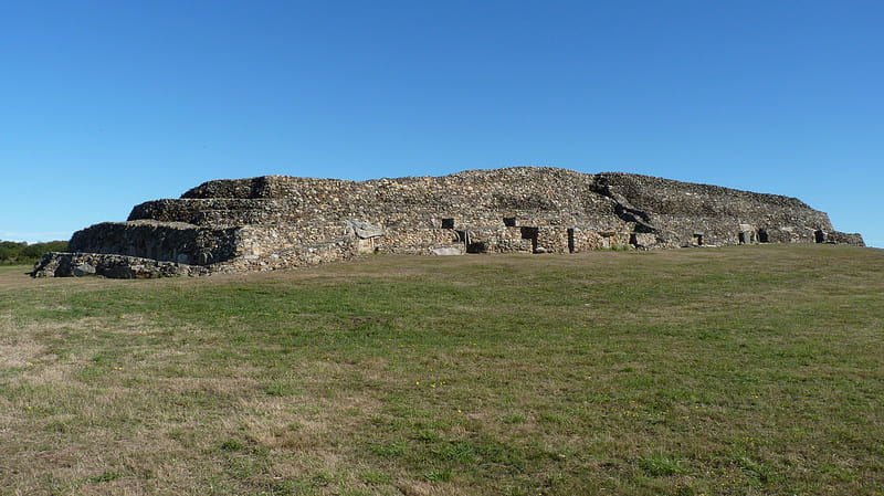
Cairn Structure: The tumulus is approximately 72 meters (236 feet) long, 25 meters (82 feet) wide, and over 8 meters (26 feet) high. It is constructed from thousands of large stones, creating a substantial and imposing monument.
Passage Graves: The cairn contains eleven passage graves, each with a narrow corridor leading to a burial chamber. These passage graves are oriented in various directions, indicating different construction phases and cultural influences over time.
Construction Phases: The monument was built in two main phases. The first phase involved the construction of five passage graves, followed by an extension that added six more graves and enlarged the cairn. The different construction phases are evident in the architectural styles and the arrangement of the graves.
Decorative Elements: Some of the stones used in the construction of the passage graves feature carvings and engravings, including abstract patterns and motifs that are characteristic of Neolithic art. These decorations provide insights into the symbolic and ritualistic aspects of the site.
Function and Significance
Barnenez served as a collective burial site for the Neolithic communities in the region. The passage graves were used for the interment of multiple individuals, along with grave goods such as pottery, tools, and personal ornaments. The monument's size and complexity reflect its importance as a ceremonial and communal site.
The Barnenez Tumulus is significant for several reasons:
Early Monumental Architecture: Barnenez represents one of the earliest examples of large-scale megalithic construction in Europe, highlighting the advanced engineering and organizational skills of Neolithic societies.
Funerary Practices: The site provides valuable insights into the burial customs and social structures of early agricultural communities. The collective nature of the burials suggests a communal approach to death and remembrance.
Cultural Continuity: The construction of the tumulus in multiple phases over several centuries indicates a long-term continuity of cultural and ritual practices in the region.
Archaeological Discoveries
Excavations at Barnenez have uncovered numerous artifacts and remains that shed light on the lives of its builders and users:
Human Remains: The burial chambers contained the skeletal remains of several individuals, providing information on health, diet, and mortuary practices.
Grave Goods: Objects found in the graves include pottery, stone tools, and personal ornaments, offering insights into the material culture and daily life of Neolithic communities.
Carved Stones: The engraved stones at Barnenez are important examples of Neolithic art and symbolism, reflecting the spiritual and ritualistic beliefs of the time.
Preservation and Tourism
Today, Barnenez is a protected archaeological site and a popular tourist attraction. Efforts have been made to preserve the structure and prevent further damage from environmental and human factors. Visitors to Barnenez can explore the site and learn about its historical and cultural significance through guided tours and informational displays.
The Barnenez Tumulus is a remarkable testament to the architectural and cultural achievements of early Neolithic societies in Western Europe. Its impressive scale, intricate construction, and rich archaeological findings make it an essential site for understanding the development of prehistoric monumental architecture and funerary practices. As one of the oldest and most significant megalithic structures in Europe, Barnenez continues to offer valuable insights into the lives and beliefs of our distant ancestors.
Knap of Howar, United Kingdom (Scotland): 3700 BC, house.
The Knap of Howar is one of the oldest preserved stone houses in northern Europe, dating back to around 3700 BC. Located on the island of Papa Westray in the Orkney archipelago, Scotland, this Neolithic site offers a rare and well-preserved glimpse into early domestic architecture and daily life during the Neolithic period.
Discovery and Excavation
The Knap of Howar was first identified in the 1930s, but it was not until the 1970s that systematic excavations were conducted by the archaeologist Anna Ritchie. The site was revealed to be an exceptionally well-preserved farmstead, consisting of two adjacent stone-built houses.
Architecture and Structure
The Knap of Howar comprises two interconnected stone structures, which are thought to have been used as a farmhouse and ancillary building. Key architectural features include:
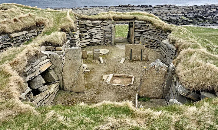
Stone Construction: The buildings are constructed from large flat stones, typical of the local geology. The walls are drystone built, with no use of mortar, and are remarkably well-preserved due to the protective covering of sand dunes before their excavation.
Interconnected Buildings: The site includes two adjacent buildings connected by a low passageway. The larger building served as the main dwelling, while the smaller structure may have been used for storage or as a workshop.
Interior Layout: The interiors of the buildings feature stone-built furniture, including hearths, stone benches, and storage areas. These features indicate a sophisticated level of domestic organization and a comfortable living environment.
Entrances and Windows: The main building has a single entrance and small windows or vents, which would have provided limited light and ventilation while retaining heat.
Function and Use
The Knap of Howar served as a farmstead for a small Neolithic community. The well-preserved nature of the site provides a detailed look at daily life during this period:
Agriculture and Animal Husbandry: The inhabitants practiced early forms of farming, cultivating crops such as barley and wheat and domesticating animals like cattle, sheep, and pigs. The presence of stone tools and pottery also indicates the processing and storage of food.
Domestic Life: The stone-built furniture and layout of the buildings suggest a well-organized domestic space. The hearths would have been central to daily life, providing heat, light, and a place for cooking.
Crafts and Activities: Evidence of tool-making and other craft activities within the smaller building suggests that the inhabitants engaged in various domestic and economic activities beyond simple subsistence farming.
Cultural and Historical Significance
The Knap of Howar is significant for several reasons:
Early Stone Construction: The site represents some of the earliest examples of stone-built domestic architecture in northern Europe. The use of durable materials and the quality of construction reflect advanced building techniques for the time.
Insight into Neolithic Life: The farmstead provides a valuable snapshot of daily life during the Neolithic period, offering insights into the social and economic organization of early agricultural communities.
Preservation and Continuity: The exceptional preservation of the site allows for detailed study of Neolithic architecture and domestic practices. It also highlights the continuity of human occupation in the Orkney Islands, which has a rich archaeological heritage spanning several millennia.
Archaeological Discoveries
Excavations at the Knap of Howar have uncovered numerous artifacts that shed light on the lives of its inhabitants:
Pottery: Pottery fragments found at the site include plain and decorated vessels used for storage, cooking, and serving food.
Stone Tools: Tools made from locally available stone, such as flint and chert, include knives, scrapers, and other implements used for farming, food preparation, and craft activities.
Animal Bones and Plant Remains: The remains of domesticated animals and charred plant materials provide evidence of the diet and agricultural practices of the inhabitants.
Preservation and Tourism
Today, the Knap of Howar is a protected archaeological site managed by Historic Environment Scotland. It is accessible to the public, with interpretive signage providing information about the site's history and significance. The site attracts researchers and tourists interested in early human history and Neolithic life in the Orkney Islands.
The Knap of Howar is a remarkable example of early Neolithic domestic architecture and offers a unique window into the lives of some of the earliest farmers in northern Europe. Its well-preserved structures and artifacts provide invaluable insights into the social, economic, and cultural practices of its inhabitants. As one of the oldest stone houses in the region, the Knap of Howar remains a vital site for understanding the development of human settlement and architecture during the Neolithic period.
La Hougue Bie, Jersey: 4000-3500 BC, passage grave.
La Hougue Bie is a significant prehistoric site located on the island of Jersey in the Channel Islands. Dating back to between 4000 and 3500 BC, this passage grave is one of the finest examples of Neolithic funerary architecture in Europe. The site comprises a large burial mound with an interior stone passage and chambers, covered by an earthen mound.
Discovery and Excavation
La Hougue Bie was first excavated in the 1920s, and subsequent archaeological work has continued to uncover its secrets. The site has been well-preserved, allowing for detailed studies of its construction and use. Early investigations revealed not only the Neolithic passage grave but also medieval structures and evidence of World War II use, indicating the site's long and varied history.
Architecture and Structure
La Hougue Bie consists of several key architectural features:
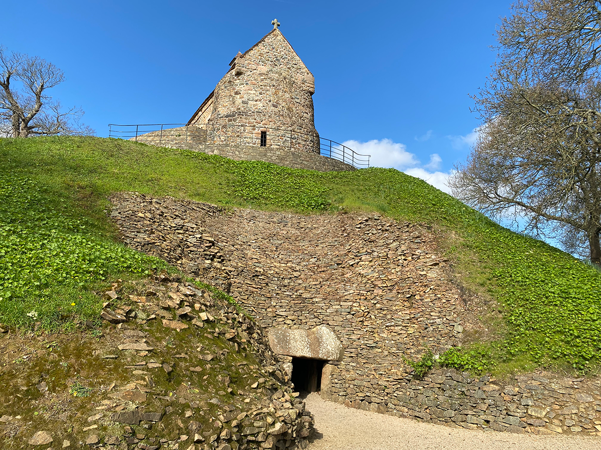
Passage Grave: The central feature is a long stone passage leading to a burial chamber. The passage is about 18.6 meters (61 feet) long and constructed from large upright stones (orthostats) capped with horizontal stone slabs (capstones).
Burial Chamber: The passage terminates in a large chamber that was used for communal burials. This chamber is built with carefully placed stones, creating a corbelled roof that supports the weight of the earthen mound above.
Earthen Mound: The burial chamber and passage are covered by a substantial mound of earth, creating an artificial hillock. The mound is approximately 12 meters (40 feet) high and 58 meters (190 feet) in diameter, making it one of the largest of its kind.
Medieval Chapel: On top of the mound, there is a 12th-century chapel dedicated to Notre Dame de Clarté, and a later medieval chapel was added in the 16th century. These structures reflect the site's continued use and significance through different historical periods.
Function and Use
La Hougue Bie served as a communal burial site for Neolithic communities. The passage grave was used for the interment of multiple individuals, along with grave goods such as pottery, tools, and personal ornaments. The careful construction and large size of the mound indicate the importance of the site for ceremonial and funerary practices.
Ceremonial Significance: The alignment of the passage with the rising sun on the equinoxes suggests that La Hougue Bie had an astronomical and ceremonial function. This alignment would have illuminated the burial chamber during these times, likely playing a role in ritual observances.
Social Organization: The construction of such a monumental structure would have required significant communal effort and coordination, reflecting the social and organizational capabilities of the Neolithic inhabitants.
Cultural and Historical Significance
La Hougue Bie is notable for several reasons:
Neolithic Engineering: The site's construction demonstrates advanced knowledge of stone-working and engineering techniques among Neolithic builders. The use of large stones and corbelling to create a stable roof structure is particularly impressive.
Historical Continuity: The addition of medieval chapels on top of the mound highlights the site's continued significance over thousands of years. This layering of historical periods makes La Hougue Bie unique in its demonstration of long-term human occupation and reverence.
Preservation of Neolithic Culture: The artifacts and human remains found at La Hougue Bie provide valuable insights into the life, death, and beliefs of Neolithic communities in the region. The site's excellent preservation allows for ongoing research and education.
Archaeological Discoveries
Excavations at La Hougue Bie have yielded numerous important finds:
Human Remains: Skeletal remains found in the burial chamber provide information on the health, diet, and burial practices of the Neolithic inhabitants.
Grave Goods: Items such as pottery, stone tools, and ornaments have been uncovered, offering insights into the material culture and daily life of the period.
Medieval Artifacts: The remains of the medieval chapels and associated artifacts reflect the site's continued use and religious significance through the centuries.
Preservation and Tourism
Today, La Hougue Bie is managed by Jersey Heritage and is open to the public. The site includes a museum with displays on the Neolithic period, the medieval chapels, and the site's use during World War II, when it was part of the island's German fortifications. Visitors can explore the passage grave and the chapels, learning about the site's rich history through interpretive exhibits and guided tours.
La Hougue Bie stands as a remarkable testament to the architectural and cultural achievements of Neolithic societies. Its well-preserved passage grave provides valuable insights into early funerary practices and social organization. The site's long history, including its medieval and modern use, underscores its enduring significance and the continuity of human occupation on the island of Jersey. La Hougue Bie remains a vital site for understanding the development of early human societies and their lasting impact on the landscape.
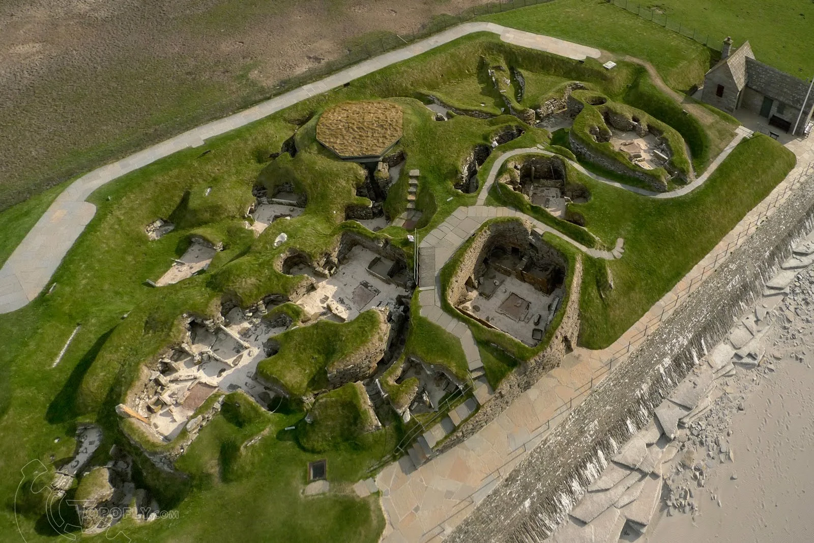
Skara Brae, United Kingdom (Scotland): 3180 BC, settlement.
Skara Brae is a well-preserved Neolithic settlement located on the west coast of Mainland, the largest island in the Orkney archipelago, Scotland. Dating back to around 3180 BC, Skara Brae is one of the best-preserved groups of prehistoric houses in Western Europe. Often referred to as the "Scottish Pompeii," the site offers an unparalleled glimpse into the domestic life of Europe's early farming communities.
Discovery and Excavation
Skara Brae was discovered in 1850 after a severe storm exposed part of the village from beneath the sand dunes that had covered it for millennia. Subsequent excavations, particularly those led by archaeologist V. Gordon Childe in the 1920s and 1930s, revealed a complex of well-preserved stone buildings connected by covered passageways.
Architecture and Structure
The settlement consists of eight clustered houses, built from local stone slabs. These houses share several common architectural features:
Stone Construction: The buildings are constructed from flat, stacked stones without the use of mortar. The thick stone walls and partially subterranean construction helped to insulate the houses against the harsh Orkney weather.
Interconnected Dwellings: The houses are connected by a series of low, covered passageways, which would have provided protection from the elements while moving between structures.
Interior Features: Each house typically contains a central hearth, stone beds built into the walls, and stone dressers or cupboards. These features indicate a high level of domestic organization and comfort. The hearths were used for heating and cooking, while the beds and storage units suggest attention to indoor furnishings and space utilization.
Roofing: The roofs were likely made of organic materials such as turf or thatch, supported by wooden beams or whale ribs, though these have not survived.
Function and Use
Skara Brae was a thriving village occupied by a small community of farmers and fishers. The well-organized layout and sturdy construction reflect a settled lifestyle centered around agriculture, fishing, and animal husbandry.
Agriculture and Animal Husbandry: The inhabitants of Skara Brae grew barley and wheat and raised domesticated animals such as cattle and sheep. The agricultural practices supported a stable and sustainable food supply.
Fishing and Gathering: Proximity to the sea provided access to fish, shellfish, and other marine resources, which supplemented the diet of the inhabitants.
Craftsmanship and Tools: Numerous stone and bone tools, pottery, and decorative items have been found at Skara Brae, indicating a community skilled in crafting and trade. The presence of finely made objects suggests a degree of social complexity and specialization.
Cultural and Historical Significance
Skara Brae provides significant insights into the social and domestic life of Neolithic communities in Europe:
Advanced Domestic Life: The settlement's architecture and interior furnishings demonstrate a high level of domestic comfort and organization, reflecting advanced building techniques and social structures.
Preservation of Daily Life: The exceptional preservation of Skara Brae allows for detailed studies of daily life, from cooking and sleeping arrangements to social interactions and trade.
Window into the Past: The site is invaluable for understanding the broader cultural and technological developments of the Neolithic period in Europe. It offers evidence of early human adaptation to a challenging environment and the development of a stable, community-oriented lifestyle.
Archaeological Discoveries
Excavations at Skara Brae have yielded a wealth of artifacts that provide a detailed picture of its inhabitants' lives:
Pottery: Pottery shards and complete vessels have been found, showing a variety of styles and uses.
Tools and Implements: Stone and bone tools, such as knives, scrapers, and fishing gear, reveal the daily activities and skills of the inhabitants.
Decorative Items: Beads, pendants, and carved stone objects suggest a cultural emphasis on personal adornment and artistic expression.
Preservation and Tourism
Today, Skara Brae is managed by Historic Environment Scotland and is a UNESCO World Heritage Site as part of the "Heart of Neolithic Orkney" group, which also includes Maeshowe, the Ring of Brodgar, and the Stones of Stenness. The site is open to the public, with a visitor center that provides educational exhibits and guided tours.
Efforts are ongoing to preserve Skara Brae from environmental threats, including coastal erosion and climate change. These measures ensure that the site remains a valuable resource for both researchers and the public.
Skara Brae is a remarkable testament to the ingenuity and resilience of Neolithic communities. Its well-preserved structures and artifacts provide an unparalleled window into the daily life of Europe's early farmers. The site continues to captivate and inform, offering valuable insights into the development of human society and the enduring legacy of our prehistoric ancestors. As one of the best-preserved Neolithic settlements in the world, Skara Brae stands as a vital link to our distant past.
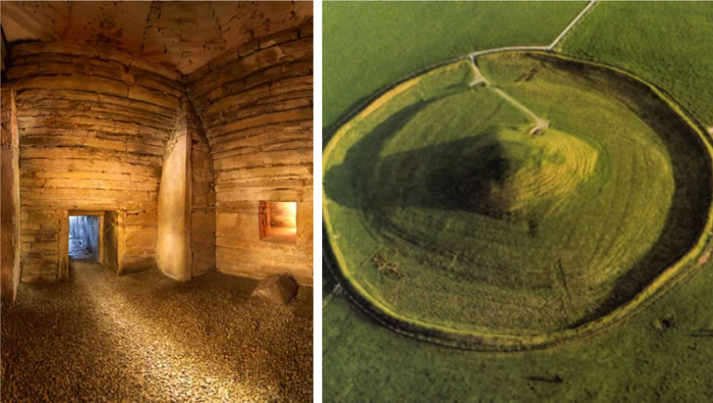
Maeshowe, United Kingdom (Scotland): 2800 BC, tomb.
Maeshowe is a large Neolithic chambered tomb located on Mainland, the largest island in the Orkney archipelago of Scotland. Dating back to around 2800 BC, it is one of the finest examples of prehistoric architecture in Europe and is renowned for its impressive construction and alignment with the winter solstice. Maeshowe is part of the UNESCO World Heritage Site known as the "Heart of Neolithic Orkney," which includes other notable sites such as Skara Brae, the Ring of Brodgar, and the Stones of Stenness.
Discovery and Excavation
Maeshowe has been known for centuries, but it was first systematically excavated in 1861 by James Farrer, a British antiquarian. During the excavation, Farrer discovered the tomb's entrance passage and central chamber, along with a series of Norse runic inscriptions from the 12th century.
Architecture and Structure
Maeshowe is a sophisticated example of Neolithic engineering and design, characterized by its massive size and intricate construction:
Mound and Dimensions: The tomb is covered by a large, grassy mound measuring about 35 meters (115 feet) in diameter and rising to a height of 7 meters (23 feet). The mound is constructed from layers of turf and stone, creating an imposing presence on the landscape.
Entrance Passage: The entrance to Maeshowe is a 10-meter-long (33 feet) passage lined with large stone slabs. The passage is low and narrow, requiring visitors to crouch as they enter. It is precisely aligned with the setting sun of the winter solstice, allowing sunlight to illuminate the inner chamber during this time of year.
Central Chamber: The passage leads to a central chamber measuring about 4.5 meters (15 feet) square, with a corbelled roof that rises to a height of around 4 meters (13 feet). The corbelling technique involves overlapping stones to create a stable, beehive-shaped ceiling, which is a hallmark of Neolithic construction.
Side Chambers: Three smaller side chambers branch off from the central chamber, each constructed from carefully placed stone slabs. These chambers were used for the burial of human remains and the storage of grave goods.
Function and Use
Maeshowe served as a communal burial site for Neolithic inhabitants of the Orkney Islands. Its construction and alignment suggest that it played a significant role in the ceremonial and spiritual life of the community:
Burial Practices: The tomb was used for the interment of multiple individuals, reflecting the communal nature of Neolithic burial practices. The central and side chambers would have housed the remains of the deceased, along with various grave goods such as pottery, tools, and personal ornaments.
Astronomical Alignment: The alignment of the entrance passage with the winter solstice sunset indicates that Maeshowe had an astronomical and ceremonial function. This alignment would have created a dramatic effect during the solstice, reinforcing the tomb's significance as a spiritual and communal gathering place.
Cultural and Historical Significance
Maeshowe is significant for several reasons:
Architectural Mastery: The tomb's construction demonstrates advanced knowledge of engineering and architectural techniques among Neolithic builders. The precise alignment and corbelled roofing reflect a high degree of skill and planning.
Cultural Insights: Maeshowe provides valuable insights into the social and spiritual practices of Neolithic communities in Orkney. The tomb's use for communal burials and its solstice alignment suggest a complex belief system centered around death, the afterlife, and the natural world.
Runic Inscriptions: The tomb contains a series of runic inscriptions carved by Norse visitors in the 12th century. These inscriptions, some of the largest collections of runes in Europe, add a layer of historical and cultural significance to the site, linking the Neolithic builders with later Viking settlers.
Archaeological Discoveries
Excavations at Maeshowe have uncovered numerous artifacts and features that shed light on its use and significance:
Human Remains: Skeletal remains found in the side chambers provide information on the health, diet, and burial practices of the Neolithic inhabitants.
Grave Goods: Artifacts such as pottery, stone tools, and decorative items have been found within the tomb, offering insights into the material culture and daily life of the period.
Runic Inscriptions: The runic carvings, made by Norsemen who broke into the tomb in the 12th century, include names, poems, and references to Norse mythology. These inscriptions provide a fascinating glimpse into the interaction between Neolithic and Norse cultures.
Preservation and Tourism
Today, Maeshowe is managed by Historic Environment Scotland and is part of the "Heart of Neolithic Orkney" UNESCO World Heritage Site. The tomb is a popular tourist attraction, with guided tours available to help visitors understand its historical and cultural significance.
Efforts are ongoing to preserve Maeshowe from environmental threats, including water infiltration and structural erosion. These preservation measures ensure that the site remains a valuable resource for both researchers and the public.
Maeshowe stands as a remarkable testament to the ingenuity and spiritual life of Neolithic communities in Scotland. Its impressive construction, astronomical alignment, and rich archaeological findings provide invaluable insights into the social and cultural practices of Europe's early farmers. As one of the finest examples of Neolithic chambered tombs, Maeshowe continues to captivate and educate, offering a unique window into the distant past.
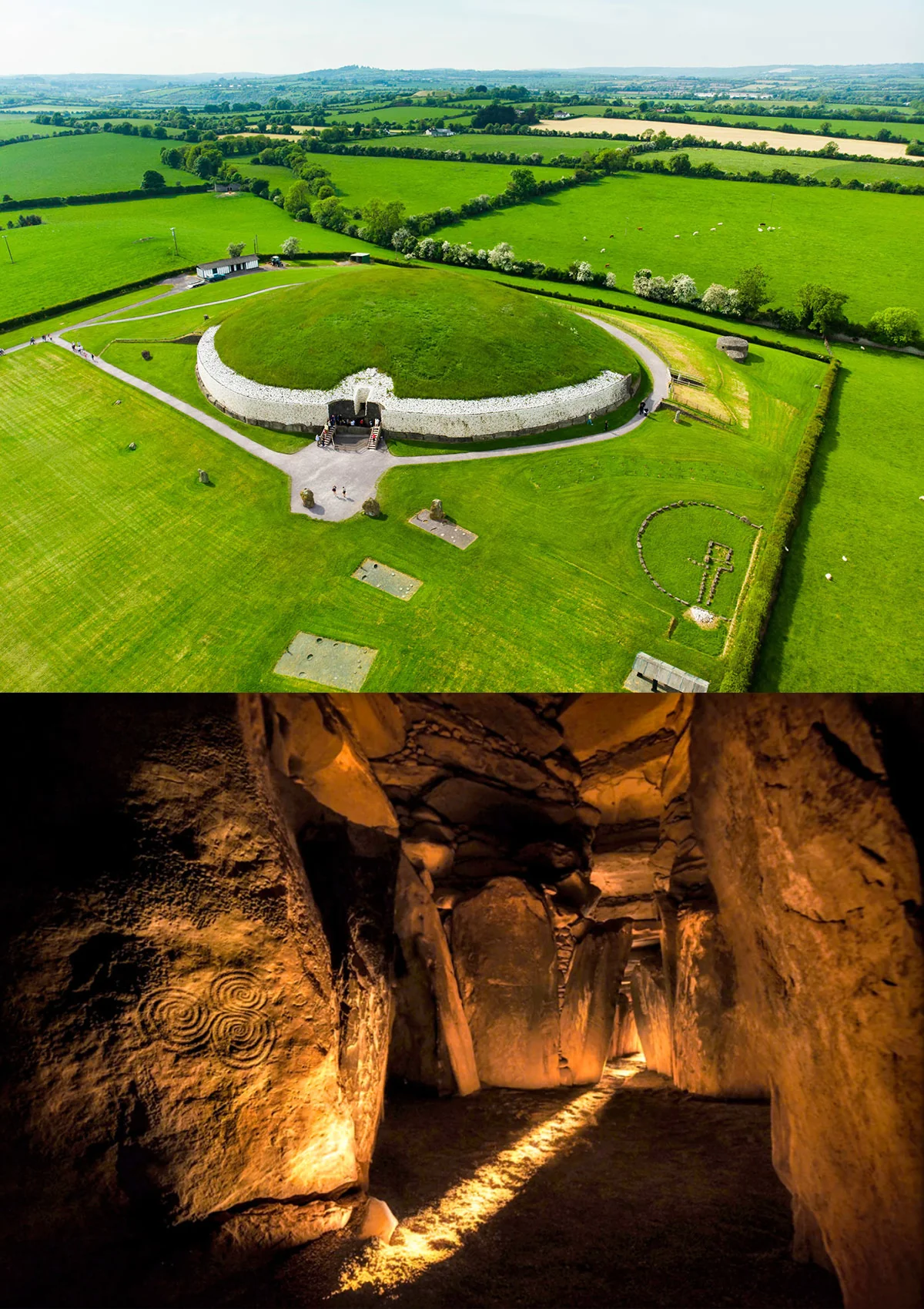
Newgrange, Ireland: 3200 BC, burial.
Newgrange is a prehistoric passage tomb located in the Boyne Valley, County Meath, Ireland. Dating back to around 3200 BC, it is older than both Stonehenge and the Great Pyramids of Giza. Newgrange is part of the Brú na Bóinne UNESCO World Heritage Site, which also includes the similar sites of Knowth and Dowth. Renowned for its impressive construction, astronomical alignment, and rich historical significance, Newgrange is one of the most important Neolithic sites in Europe.
Discovery and Excavation
Newgrange was rediscovered in 1699, but systematic archaeological excavation did not begin until the 20th century. The most significant work was conducted by Professor Michael J. O'Kelly from 1962 to 1975. These excavations revealed the full extent of the monument and its complex design, as well as numerous artifacts and human remains.
Architecture and Structure
Newgrange is a large circular mound with an interior passage and chamber, demonstrating sophisticated Neolithic engineering:
Mound and Dimensions: The mound is approximately 85 meters (279 feet) in diameter and 13 meters (43 feet) high, covering an area of about 1 acre. It is made up of alternating layers of earth and stones.
Kerbstones: The base of the mound is surrounded by 97 large kerbstones, many of which are decorated with megalithic art, including spirals, lozenges, and other abstract motifs. The most famous is the entrance stone, which features intricate carvings.
Passage and Chamber: A 19-meter-long (62 feet) stone passage leads to a cruciform (cross-shaped) inner chamber. The passage is lined with large stone slabs, and the chamber is topped by a corbelled roof that rises to a height of 6 meters (20 feet).
Roof Box: Above the entrance to the passage is a unique feature known as the "roof box." This opening allows sunlight to penetrate the passage and illuminate the inner chamber at sunrise during the winter solstice, highlighting the builders' advanced understanding of astronomy.
Decorative Art: The stones within the passage and chamber are adorned with carvings, representing some of the finest examples of European Neolithic art. The motifs include spirals, zigzags, and concentric circles, which may have had symbolic or ritual significance.
Function and Use
Newgrange served as a communal burial site and a place of ritual and ceremony. Its design and features indicate a multifaceted function:
Burial Site: The chamber contained the cremated remains of several individuals, suggesting it was used for burial over an extended period. The presence of grave goods, such as pottery, beads, and tools, indicates the significance of the site in funerary practices.
Astronomical Alignment: The alignment of the passage with the winter solstice sunrise suggests that Newgrange had an astronomical and ceremonial function. This alignment would have created a dramatic visual effect during the solstice, likely playing a central role in ritual observances and marking the rebirth of the sun in the Neolithic calendar.
Ritual and Ceremonial Center: The monument's size, complexity, and decoration indicate that it was a place of significant ritual activity, serving as a focal point for the community's spiritual and ceremonial life.
Cultural and Historical Significance
Newgrange is significant for several reasons:
Architectural Mastery: The construction of Newgrange demonstrates advanced engineering skills and a sophisticated understanding of astronomy among Neolithic people. The corbelled roof, in particular, is a remarkable feat of prehistoric engineering.
Cultural Insights: The carvings and artifacts found at Newgrange provide valuable insights into the symbolic and ritual practices of Neolithic societies. The motifs used in the carvings suggest a rich cultural and spiritual life.
Historical Continuity: The site remained significant through subsequent ages, influencing later cultures in Ireland. It also shows continuity in human occupation and the development of complex social structures.
Archaeological Discoveries
Excavations at Newgrange have uncovered a wealth of artifacts and remains that shed light on its use and significance:
Human Remains: The cremated remains of several individuals have been found in the chamber, indicating its use as a burial site.
Grave Goods: Artifacts such as pottery, beads, pendants, and stone tools have been discovered, offering insights into the material culture of the Neolithic inhabitants.
Decorative Carvings: The megalithic art on the kerbstones and interior stones is some of the finest in Europe, providing clues to the symbolic and ritualistic practices of the builders.
Preservation and Tourism
Today, Newgrange is a protected national monument managed by the Office of Public Works (OPW) in Ireland. It is one of Ireland's most visited heritage sites, attracting tourists and researchers from around the world.
Visitor Access: The site is accessible to the public, with guided tours provided by the Brú na Bóinne Visitor Centre. Visitors can explore the passage tomb and learn about its history, construction, and significance through exhibits and interpretive displays.
Preservation Efforts: Ongoing preservation efforts ensure the site's protection from environmental and human-induced damage. These measures are crucial for maintaining the integrity of this ancient monument for future generations.
Newgrange is a remarkable testament to the ingenuity and cultural richness of Neolithic societies in Ireland. Its impressive architecture, astronomical alignment, and rich archaeological findings make it one of the most significant prehistoric sites in Europe. As a symbol of ancient human achievement and a focal point of ritual and ceremony, Newgrange continues to captivate and educate, offering valuable insights into the lives and beliefs of our distant ancestors.
Africa
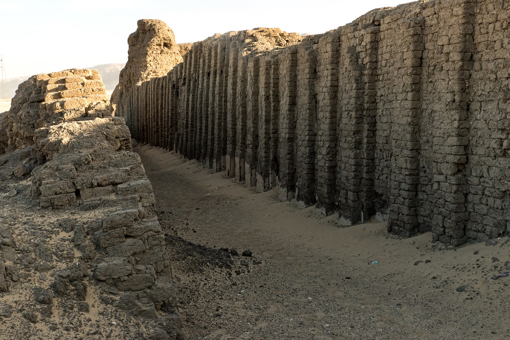
Shunet El Zebib, Egypt: 2700 BC, mortuary temple.
Shunet El Zebib, also known as the "Shunet ez-Zebib," is one of the oldest surviving mudbrick structures in Egypt, dating back to approximately 2700 BC. Located in the Abydos region, it is a mortuary temple built during the 2nd Dynasty by Pharaoh Khasekhemwy. This structure is an important precursor to the later, more famous mortuary complexes of the Old Kingdom, such as those at Giza.
Historical Significance
Shunet El Zebib is significant for several reasons. It provides valuable insights into the early development of royal funerary practices in ancient Egypt and the evolution of monumental architecture. The temple served as a model for subsequent mortuary complexes, influencing the construction of the step pyramid of Djoser and other royal tombs.
Architecture and Structure
Shunet El Zebib is a large rectangular enclosure measuring approximately 123 meters by 64 meters. The walls, made of sun-dried mudbricks, stand up to 5 meters high in some places. The enclosure was originally about 12 meters high, emphasizing its monumental scale.
Key architectural features include:
Double Wall Construction: The structure consists of two parallel walls, an outer and an inner wall, with the space between them filled with rubble. This construction technique provided additional stability and durability.
Niched Facades: The outer walls feature a series of deep niches, a decorative style that became characteristic of royal tombs and mortuary temples. These niches were likely symbolic, representing the facade of a palace and reinforcing the king's eternal presence.
Courtyards and Inner Chambers: Inside the enclosure, there were several courtyards and small chambers. These spaces were used for various religious and ceremonial purposes, including offerings to the deceased king.
Function and Use
Shunet El Zebib served as a mortuary temple, a place where the cult of the deceased king was practiced. Rituals and offerings were conducted to ensure the king's transition to the afterlife and his continued existence as a divine being. The temple likely hosted annual festivals and ceremonies, which were attended by priests and possibly the general populace.
The structure's monumental size and complexity reflect the increasing importance of the king's role in society and the development of state-sponsored religious practices. Shunet El Zebib's design and function foreshadowed the grander mortuary complexes of the Old Kingdom, which included pyramids and extensive temple complexes.
Archaeological Discoveries
Archaeological excavations at Shunet El Zebib have provided valuable information about early dynastic Egypt. Excavators have uncovered artifacts such as pottery, tools, and inscriptions that shed light on the religious practices and daily life of the period.
The structure also contains evidence of restoration and modifications, indicating its continued use and significance over several generations. Some of the inscriptions found at the site include the earliest known examples of the use of the royal serekh, a precursor to the cartouche used to encircle and protect the pharaoh's name.
Preservation and Challenges
Shunet El Zebib, like many ancient structures, faces challenges related to preservation. The mudbrick construction is particularly vulnerable to erosion and weathering. Efforts have been made to stabilize and preserve the remaining structures to prevent further deterioration.
Today, Shunet El Zebib is part of the larger archaeological landscape of Abydos, which includes numerous temples, tombs, and other significant structures from various periods of ancient Egyptian history. The site continues to attract researchers and tourists interested in the early development of Egyptian architecture and religious practices.
Shunet El Zebib is a crucial site for understanding the early dynastic period of ancient Egypt. Its architectural features and historical context provide insights into the evolution of royal mortuary practices and the development of monumental construction techniques. As one of the oldest surviving mudbrick structures, it serves as a testament to the ingenuity and religious devotion of early Egyptian society.
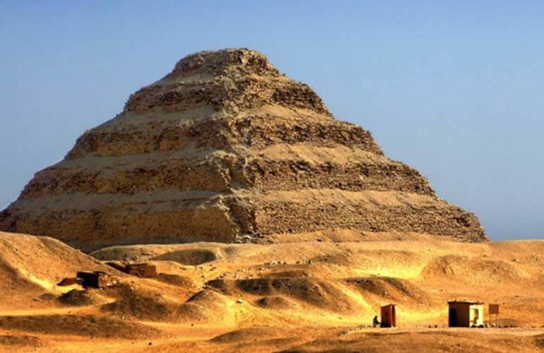
Pyramid of Djoser, Egypt: 2667-2648 BC, burial.
The Pyramid of Djoser, also known as the Step Pyramid, is located in the Saqqara necropolis, northwest of the ancient city of Memphis in Egypt. Constructed during the 27th century BC for Pharaoh Djoser by his architect Imhotep, it is the earliest colossal stone building in Egypt and one of the first pyramids ever built. The Pyramid of Djoser represents a critical development in ancient Egyptian architecture and the evolution of pyramid construction.
Historical Significance
The Pyramid of Djoser marks a significant departure from the traditional mastaba tombs used by earlier Egyptian pharaohs. It represents the first large-scale use of stone as a building material in Egypt and is considered a precursor to the later smooth-sided pyramids, such as those at Giza. Its construction reflects advancements in engineering and state organization, showcasing the capabilities of early Dynastic Egypt.
Architecture and Structure
The Pyramid of Djoser is a step pyramid, consisting of six mastaba-like layers stacked on top of each other, creating a stepped profile. Key architectural features include:
Size and Dimensions: The pyramid originally stood about 62 meters (203 feet) high and had a base measuring approximately 109 meters by 121 meters (358 feet by 397 feet).
Step Pyramid Design: Unlike the later smooth-sided pyramids, the Pyramid of Djoser has a stepped appearance. Each of the six steps represents a level of mastabas of decreasing size stacked upon one another. This design was revolutionary and symbolized a stairway to the heavens.
Limestone Construction: The pyramid is constructed from limestone blocks, a departure from the traditional mudbrick construction of earlier tombs. The use of stone not only provided greater durability but also allowed for more monumental architecture.
Complex Surrounding Structures: The pyramid is part of a larger mortuary complex that includes a network of courtyards, temples, and shrines. The entire complex is surrounded by a high wall with 14 gateways, though only one is functional. The complex was designed to serve both as a burial site and a center for the king's posthumous cult.
Underground Chambers: Beneath the pyramid lies a series of underground chambers and tunnels, including the burial chamber of Djoser. These chambers were intended to hold the king's body and grave goods, ensuring his safe passage to the afterlife.
Function and Use
The Pyramid of Djoser was designed as a burial place and a site for the eternal cult of the deceased king. Its primary functions included:
Royal Tomb: The pyramid served as the final resting place for Pharaoh Djoser. The burial chamber, located deep within the structure, was designed to protect the king's body and his grave goods from tomb robbers.
Religious and Ceremonial Center: The surrounding complex was used for various religious ceremonies and rituals associated with the king's afterlife. The structures within the complex, including the mortuary temple, were places where offerings were made to sustain the king's spirit.
Symbol of Divine Kingship: The monumental scale and innovative design of the pyramid symbolized the divine status of the king and his connection to the gods. It reinforced the king's role as an intermediary between the gods and the people.
Cultural and Historical Impact
The Pyramid of Djoser had a profound impact on ancient Egyptian architecture and culture:
Architectural Innovation: Designed by Imhotep, the pyramid represents a significant architectural achievement. Imhotep's use of stone and his innovative step design set a precedent for future pyramid construction.
Development of Pyramid Complexes: The complex surrounding the pyramid influenced the design of later pyramid complexes. It demonstrated the integration of a tomb with a larger ceremonial and religious site, a practice that would be refined in subsequent pyramids.
Legacy of Imhotep: Imhotep, the architect of the pyramid, was later deified as a god of wisdom and medicine. His contributions to architecture and engineering were highly revered in ancient Egyptian culture.
Preservation and Tourism
Today, the Pyramid of Djoser is a UNESCO World Heritage Site and a major tourist attraction. Efforts have been made to preserve the structure and its surrounding complex:
Restoration Projects: Extensive restoration efforts have been undertaken to stabilize the pyramid and its surrounding structures. These efforts aim to protect the site from environmental damage and structural decay.
Tourist Access: The pyramid and its complex are open to visitors, who can explore the site and learn about its historical and architectural significance through guided tours and informational displays.
The Pyramid of Djoser stands as a monumental testament to the ingenuity and architectural prowess of ancient Egypt. Its innovative design and construction set the stage for the development of later pyramids and solidified the tradition of monumental tomb building in Egyptian culture. As the earliest large-scale stone structure in Egypt, the Pyramid of Djoser remains a vital link to the past, offering valuable insights into the evolution of ancient Egyptian architecture and the society that built it.
Great Pyramid of Giza, Egypt: 2560 BC, tomb.
The Great Pyramid of Giza, also known as the Pyramid of Khufu or Cheops, is the largest and most famous of the pyramids at the Giza pyramid complex in Egypt. Built around 2560 BC during the Fourth Dynasty of the Old Kingdom, it served as the tomb for the Egyptian Pharaoh Khufu (Cheops). The Great Pyramid is the oldest of the Seven Wonders of the Ancient World and the only one to remain largely intact.
Historical Significance
The Great Pyramid of Giza is an iconic symbol of ancient Egyptian civilization and a testament to the architectural and engineering prowess of the time. It represents the pinnacle of pyramid construction and the culmination of the technological advancements and organizational skills developed over centuries.
Architecture and Structure
The Great Pyramid is renowned for its massive scale, precise construction, and intricate internal layout. Key features include:
Dimensions: Originally, the Great Pyramid stood at about 146.6 meters (481 feet) tall. Over millennia, erosion and the removal of its outer casing stones have reduced its height to the current 138.8 meters (455 feet). The base covers an area of approximately 13 acres (5.3 hectares), with each side measuring around 230.4 meters (756 feet).
Construction Materials: The pyramid is constructed primarily from limestone blocks, with an estimated 2.3 million blocks used in its construction. The core consists of locally quarried limestone, while the outer casing was made from higher-quality Tura limestone. Granite blocks were used for the inner chambers and passages.
Internal Layout: The internal structure of the Great Pyramid is complex, featuring several chambers and passageways:
King's Chamber: Located in the heart of the pyramid, the King's Chamber is made entirely of granite and contains a large granite sarcophagus.
Queen's Chamber: Situated below the King's Chamber, this smaller chamber was likely intended for Khufu's queen or had a symbolic function.
Grand Gallery: A long, ascending corridor that leads to the King's Chamber, the Grand Gallery is notable for its corbelled walls.
Descending Passage and Subterranean Chamber: A downward-sloping passage leads to an unfinished chamber beneath the pyramid, whose purpose remains uncertain.
Precision and Alignment: The Great Pyramid is aligned with incredible precision to the cardinal points of the compass. The sides of the pyramid base are closely aligned with the four cardinal directions, demonstrating the ancient Egyptians' advanced understanding of astronomy and geometry.
Construction Techniques: The exact methods used to construct the pyramid remain a subject of debate among historians and archaeologists. Various theories suggest the use of ramps, levers, and a highly organized workforce to transport and position the massive stone blocks.
Function and Use
The primary function of the Great Pyramid was as a tomb for Pharaoh Khufu, designed to ensure his safe passage to the afterlife and to serve as an eternal monument to his reign:
Royal Tomb: The King's Chamber housed Khufu's sarcophagus and likely contained his mummified body, along with grave goods intended to accompany him into the afterlife. The pyramid's internal passages and chambers were designed to protect the burial from tomb robbers and to facilitate the pharaoh's spiritual journey.
Religious and Ceremonial Site: The pyramid complex included temples and subsidiary structures used for religious and ceremonial purposes. The mortuary temple, located adjacent to the pyramid, served as a site for offerings and rituals conducted by priests to honor the deceased pharaoh.
Cultural and Historical Impact
The Great Pyramid of Giza has had a profound impact on both ancient and modern cultures:
Architectural Innovation: The pyramid's construction techniques and monumental scale set a standard for future pyramid building and influenced subsequent architectural developments in ancient Egypt.
Symbol of Power and Divine Kingship: The pyramid symbolized the pharaoh's absolute power and his divine status as a god-king. Its construction demonstrated the centralized authority and organizational capabilities of the state.
Enduring Legacy: The Great Pyramid has fascinated historians, scholars, and tourists for millennia. It continues to be a symbol of ancient Egyptian civilization and a testament to human ingenuity and ambition.
Archaeological Discoveries
Excavations and studies of the Great Pyramid have uncovered a wealth of information about its construction, use, and the society that built it:
Artifacts: Although the pyramid itself has been heavily looted over the centuries, nearby tombs and structures have yielded valuable artifacts, including tools, pottery, and inscriptions.
Inscriptions and Texts: Graffiti left by workers and inscriptions in nearby tombs provide insights into the labor force and the organization of pyramid construction.
Mortuary Complex: The surrounding complex includes smaller pyramids for Khufu's queens, mastabas for nobles, and the Great Sphinx, which is believed to be part of Khufu's pyramid complex.
Preservation and Tourism
Today, the Great Pyramid of Giza is a UNESCO World Heritage Site and one of Egypt's most popular tourist attractions. Efforts are ongoing to preserve the structure and manage the impact of tourism:
Conservation Efforts: Measures are taken to protect the pyramid from environmental damage, including erosion and pollution. Controlled access and restoration projects aim to preserve the pyramid for future generations.
Tourist Access: Visitors can explore the pyramid complex and learn about its history through guided tours and informational displays. Access to the interior chambers is limited to protect the structure.
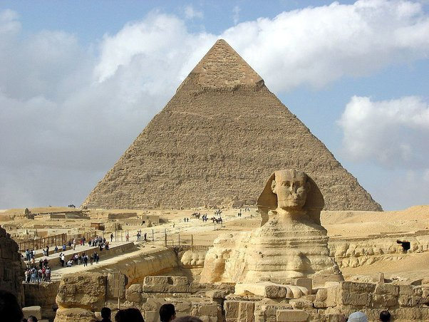
Pyramid of Khafre, Egypt: 2500 BC, tomb.
The Pyramid of Khafre, also known as the Pyramid of Chephren, is the second-largest pyramid at the Giza pyramid complex in Egypt. Built around 2500 BC during the Fourth Dynasty of the Old Kingdom, it served as the tomb for Pharaoh Khafre (also known as Chephren). The pyramid is part of a larger mortuary complex that includes the Great Sphinx of Giza, various temples, and smaller subsidiary pyramids.
Historical Significance
The Pyramid of Khafre represents the continuation of the pyramid-building tradition initiated by Pharaoh Khufu, Khafre's father. It is significant for its architectural advancements and its role in the evolution of ancient Egyptian funerary practices. The pyramid complex underscores the power and divine status of the pharaoh, reflecting the centralized authority and religious beliefs of ancient Egypt.
Architecture and Structure
The Pyramid of Khafre is distinguished by its impressive size, precise construction, and distinctive features:
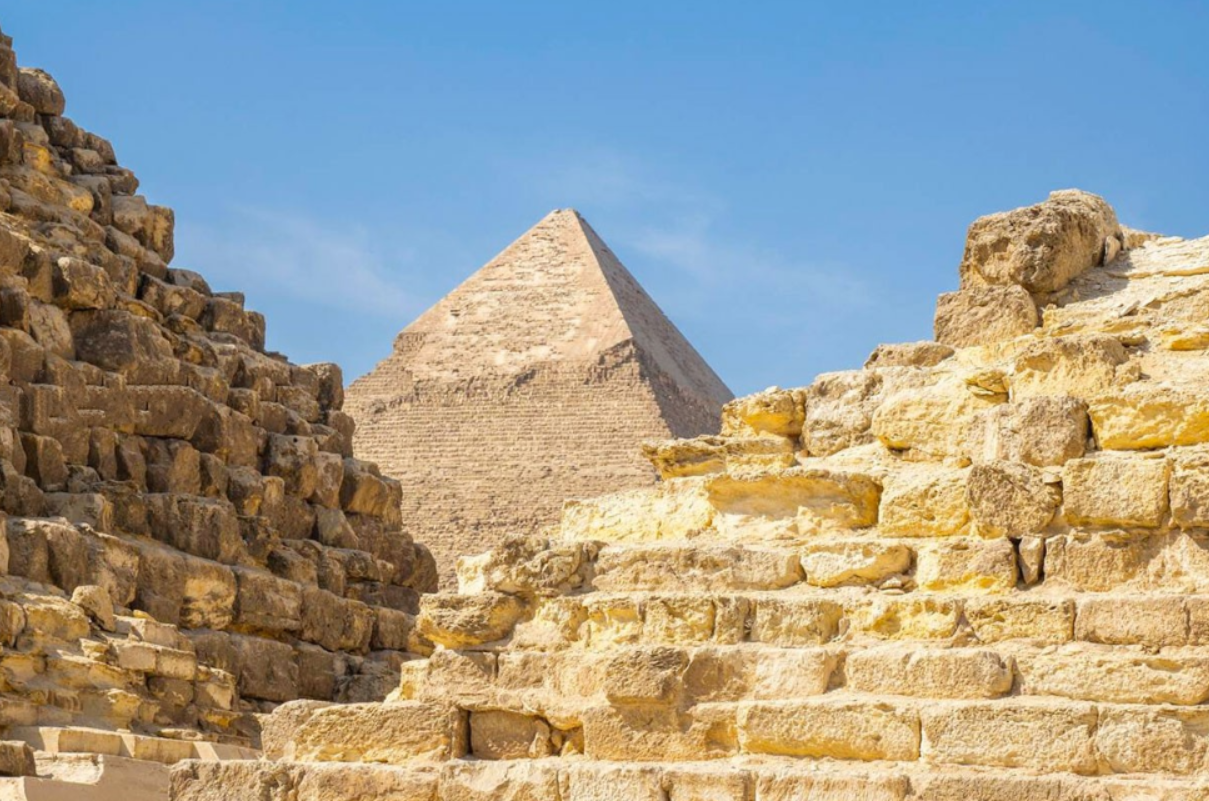
Dimensions: Originally, the Pyramid of Khafre stood at 143.5 meters (471 feet) high, but it now reaches 136.4 meters (448 feet) due to the loss of its outer casing stones. The base measures approximately 215.25 meters (706 feet) on each side. It appears taller than the Great Pyramid of Giza due to its location on higher ground and its steeper angle of inclination.
Construction Materials: The core of the pyramid is made from large blocks of limestone, while the outer casing was originally covered with fine Tura limestone, giving it a smooth, white appearance. The topmost portion still retains some of its original casing stones.
Internal Structure: The pyramid features a relatively simple internal layout compared to the Great Pyramid. Key components include:
Entrance Passage: The entrance is located on the north face, leading to a descending passage that transitions to a horizontal corridor.
Burial Chamber: The burial chamber is situated directly beneath the apex of the pyramid. It houses a large, empty granite sarcophagus, likely intended for Khafre's mummified remains.
Secondary Passages: There are additional corridors and chambers, some of which may have been used for storing grave goods or had ritual purposes.
Pyramid Complex: The pyramid is part of an extensive mortuary complex that includes:
Valley Temple: Located near the Nile River, this temple served as the initial point for the pharaoh's funerary procession.
Causeway: A long, covered causeway connects the Valley Temple to the Mortuary Temple adjacent to the pyramid.
Mortuary Temple: Situated against the east face of the pyramid, this temple was used for rituals and offerings to honor the deceased pharaoh.
Great Sphinx: The Great Sphinx, a colossal limestone statue with the body of a lion and the head of a pharaoh, is located to the southeast of the pyramid. It is widely believed to bear the likeness of Khafre.
Function and Use
The primary function of the Pyramid of Khafre was as a royal tomb, designed to ensure the pharaoh's safe passage to the afterlife and to serve as an eternal monument to his reign:
Royal Tomb: The burial chamber was intended to house Khafre's sarcophagus and his mummified body. The pyramid's layout and construction aimed to protect the burial from tomb robbers and to facilitate the pharaoh's journey to the afterlife.
Religious and Ceremonial Center: The mortuary complex, including the Valley Temple and Mortuary Temple, was the site of various rituals and ceremonies conducted by priests to honor and sustain the spirit of the deceased pharaoh. These activities ensured the continued well-being of the pharaoh in the afterlife and reinforced his divine status.
Cultural and Historical Impact
The Pyramid of Khafre has had a lasting impact on both ancient and modern cultures:
Architectural Influence: The pyramid's construction techniques and design elements influenced subsequent pyramid-building projects and set a standard for monumental architecture in ancient Egypt.
Symbol of Power and Divinity: The pyramid complex symbolized the pharaoh's divine kingship and his central role in maintaining cosmic order. It demonstrated the state's ability to mobilize resources and labor for large-scale projects.
Enduring Legacy: The Pyramid of Khafre, along with the other Giza pyramids, remains one of the most iconic symbols of ancient Egypt. It continues to captivate scholars, historians, and tourists, offering valuable insights into the civilization that built it.
Archaeological Discoveries
Excavations and studies of the Pyramid of Khafre and its complex have yielded important artifacts and information:
Artifacts: Items such as statues, inscriptions, and tools have been found in and around the pyramid complex, providing insights into the construction process and the daily lives of the workers.
Inscriptions and Texts: Hieroglyphic texts and carvings found in the temples and surrounding areas offer valuable information about the religious practices and administrative organization of the time.
Sphinx Enclosure: Excavations around the Great Sphinx have revealed various structures and inscriptions that contribute to the understanding of its construction and purpose.
Preservation and Tourism
Today, the Pyramid of Khafre is part of the Giza plateau, a UNESCO World Heritage Site, and one of Egypt's most popular tourist destinations. Preservation efforts are ongoing to protect the pyramid and its surrounding structures from environmental and human-induced damage:
Conservation Projects: Efforts include stabilizing the pyramid's structure, protecting it from erosion, and restoring damaged sections. These projects aim to preserve the site for future generations.
Tourist Access: The pyramid complex is accessible to visitors, who can explore the site and learn about its history through guided tours and informational displays. The presence of the Great Sphinx and other nearby pyramids adds to the area's allure.
The Pyramid of Khafre stands as a monumental achievement in ancient Egyptian architecture and engineering. Its construction, design, and associated mortuary complex reflect the sophistication and capabilities of the Old Kingdom. As a symbol of Khafre's reign and a testament to the grandeur of ancient Egypt, the Pyramid of Khafre continues to inspire awe and admiration. It remains an essential site for understanding the development of pyramid construction and the cultural significance of these monumental tombs in ancient Egyptian society.
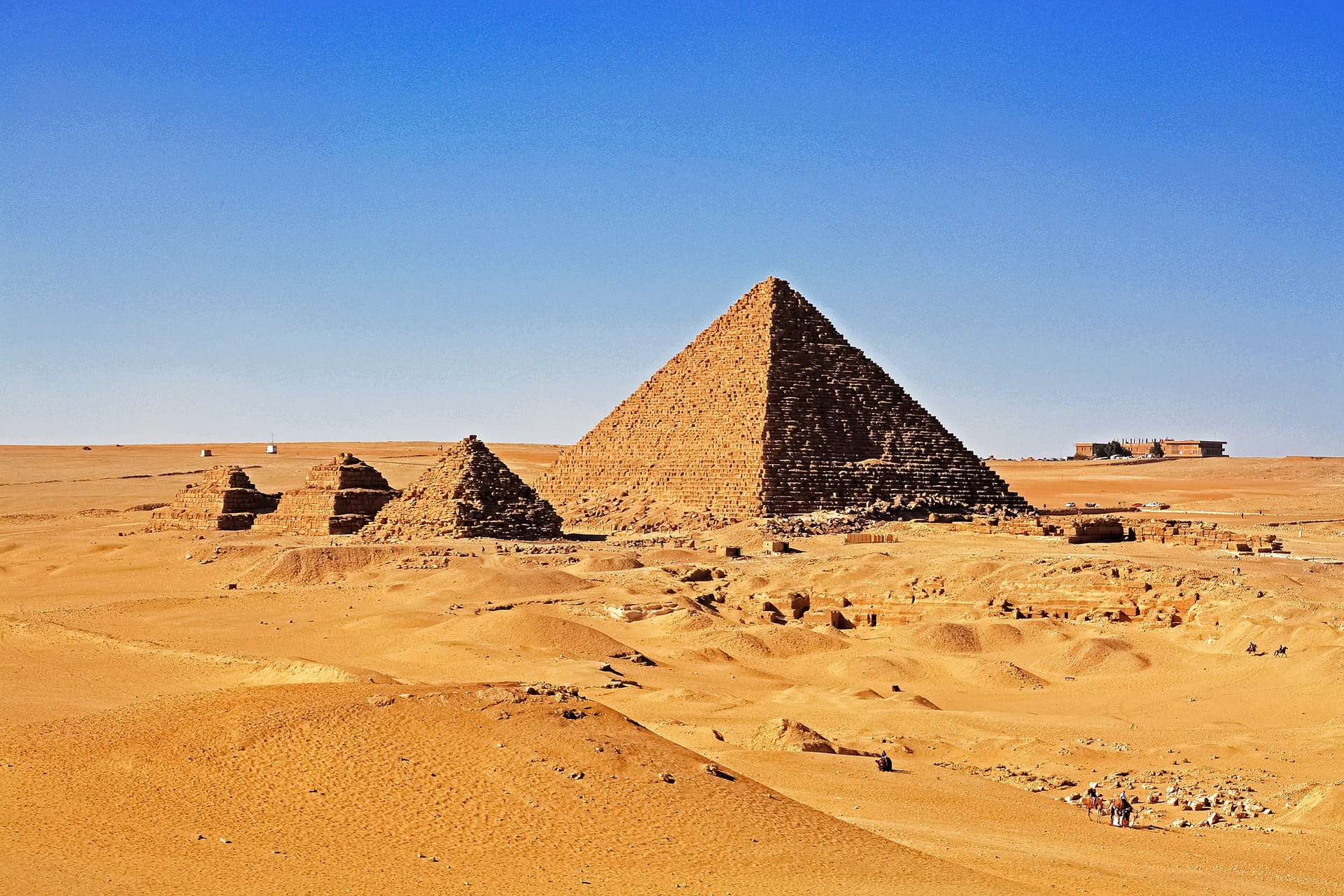
Pyramid of Menkaure, Egypt: 2490 BC, tomb.
The Pyramid of Menkaure, also known as the Pyramid of Mykerinos, is the smallest of the three main pyramids located at the Giza pyramid complex in Egypt. Built around 2490 BC during the Fourth Dynasty of the Old Kingdom, it served as the tomb for Pharaoh Menkaure (also spelled Mykerinos). Despite its smaller size compared to the pyramids of Khufu and Khafre, the Pyramid of Menkaure is notable for its complex construction and the fine quality of its materials.
Historical Significance
The Pyramid of Menkaure represents the final major pyramid built on the Giza plateau and reflects the continuing evolution of pyramid construction during the Old Kingdom. It highlights the enduring significance of pyramid building as a royal tomb practice and the advanced architectural skills of ancient Egyptian builders.
Architecture and Structure
The Pyramid of Menkaure, though smaller in scale, exhibits significant architectural precision and complexity:
Dimensions: The pyramid originally stood at approximately 65 meters (213 feet) high, but it now reaches around 61 meters (200 feet) due to the loss of its outer casing stones. The base measures about 108.5 meters (356 feet) on each side.
Construction Materials: The lower courses of the pyramid were encased in red granite, a durable and prestigious material quarried from Aswan. The upper portions were originally encased in Tura limestone. The use of high-quality granite reflects the importance of the pyramid and its builder.
Internal Structure: The internal layout of the Pyramid of Menkaure is relatively simple but includes several notable features:
Descending Passage: The entrance, located on the north face, leads to a descending passage that transitions into a horizontal corridor.
Antechamber: The passage leads to an antechamber, which may have served a ritualistic or preparatory function.
Burial Chamber: Beyond the antechamber lies the main burial chamber, which originally contained a large basalt sarcophagus, though this was lost in the 19th century. The chamber is lined with granite, underscoring its importance.
Pyramid Complex: The pyramid is part of an elaborate mortuary complex that includes:
Valley Temple: Located near the Nile River, this temple served as the initial point for the funerary procession. It featured fine reliefs and statues, including remarkable triads depicting Menkaure with various deities.
Causeway: A covered causeway connects the Valley Temple to the Mortuary Temple adjacent to the pyramid.
Mortuary Temple: This temple, built against the pyramid's east face, was used for rituals and offerings to honor Menkaure. It included storerooms, chapels, and an open courtyard.
Satellite Pyramids: Three smaller pyramids, often referred to as "queens' pyramids," are situated south of the main pyramid and were likely intended for Menkaure's consorts or used for symbolic purposes.
Function and Use
The primary function of the Pyramid of Menkaure was as a royal tomb, designed to ensure the pharaoh's safe passage to the afterlife and to serve as an eternal monument to his reign:
Royal Tomb: The burial chamber was intended to house Menkaure's sarcophagus and his mummified body. The pyramid's design aimed to protect the burial from tomb robbers and to facilitate the pharaoh's journey to the afterlife.
Religious and Ceremonial Center: The mortuary complex, including the Valley Temple and Mortuary Temple, was the site of various rituals and ceremonies conducted by priests to honor and sustain Menkaure's spirit. These activities ensured the continued well-being of the pharaoh in the afterlife and reinforced his divine status.
Cultural and Historical Impact
The Pyramid of Menkaure has had a lasting impact on both ancient and modern cultures:
Architectural Influence: The pyramid's construction techniques and design elements influenced subsequent pyramid-building projects and set a standard for monumental architecture in ancient Egypt.
Symbol of Power and Divinity: The pyramid complex symbolized the pharaoh's divine kingship and his central role in maintaining cosmic order. It demonstrated the state's ability to mobilize resources and labor for large-scale projects.
Enduring Legacy: The Pyramid of Menkaure, along with the other Giza pyramids, remains one of the most iconic symbols of ancient Egypt. It continues to captivate scholars, historians, and tourists, offering valuable insights into the civilization that built it.
Archaeological Discoveries
Excavations and studies of the Pyramid of Menkaure and its complex have yielded important artifacts and information:
Artifacts: Items such as statues, inscriptions, and tools have been found in and around the pyramid complex, providing insights into the construction process and the daily lives of the workers.
Inscriptions and Texts: Hieroglyphic texts and carvings found in the temples and surrounding areas offer valuable information about the religious practices and administrative organization of the time.
Sarcophagus: Menkaure's basalt sarcophagus, discovered in the burial chamber, was a significant find, although it was lost at sea during transport to Britain in the 19th century.
Preservation and Tourism
Today, the Pyramid of Menkaure is part of the Giza plateau, a UNESCO World Heritage Site, and one of Egypt's most popular tourist destinations. Preservation efforts are ongoing to protect the pyramid and its surrounding structures from environmental and human-induced damage:
Conservation Projects: Efforts include stabilizing the pyramid's structure, protecting it from erosion, and restoring damaged sections. These projects aim to preserve the site for future generations.
Tourist Access: The pyramid complex is accessible to visitors, who can explore the site and learn about its history through guided tours and informational displays. The presence of the Great Sphinx and other nearby pyramids adds to the area's allure.
The Pyramid of Menkaure stands as a testament to the architectural and cultural achievements of ancient Egypt. Its construction, design, and associated mortuary complex reflect the sophistication and capabilities of the Old Kingdom. As a symbol of Menkaure's reign and a testament to the grandeur of ancient Egypt, the Pyramid of Menkaure continues to inspire awe and admiration. It remains an essential site for understanding the development of pyramid construction and the cultural significance of these monumental tombs in ancient Egyptian society.
Americas
Sechin Bajo, Peru: 3500 BC, plaza.
Sechin Bajo is an ancient archaeological site located in the Casma Valley of northern Peru. Dating back to around 3500 BC, it is one of the oldest known monumental structures in the Americas. The site includes a large plaza and several other architectural features that provide valuable insights into the early development of complex societies in the Andean region.
Discovery and Excavation
Sechin Bajo was first excavated in the mid-20th century, but significant discoveries were made in the early 2000s by German and Peruvian archaeologists. These excavations revealed that the site had been occupied and developed over several millennia, with multiple construction phases indicating long-term use and significance.
Architecture and Structure
The site of Sechin Bajo comprises a large plaza and other monumental constructions, showcasing early architectural innovation:
Plaza: The central feature of Sechin Bajo is a large plaza, which is believed to have been a focal point for social, religious, and political activities. The plaza is surrounded by platforms and other structures, suggesting it was used for gatherings and ceremonies.
Circular Sunken Plaza: One of the most significant architectural elements is the circular sunken plaza, which is characteristic of early Andean ceremonial centers. This structure likely served as a venue for public rituals and community events.
Stone and Adobe Construction: The buildings and structures at Sechin Bajo were constructed using a combination of stone and adobe, reflecting early building techniques in the region. The use of large stone blocks in some areas indicates advanced masonry skills.
Complex Layout: The site features a complex layout with multiple construction phases, including superimposed structures that indicate continuous development and adaptation over time. This layering of constructions provides evidence of evolving architectural practices and social organization.
Function and Use
Sechin Bajo served as a major ceremonial and administrative center for early Andean societies. Its primary functions likely included:
Religious and Ceremonial Activities: The large plaza and sunken circular plaza suggest that Sechin Bajo was a significant site for religious rituals and public ceremonies. These activities would have played a crucial role in reinforcing social cohesion and the community's connection to their spiritual beliefs.
Social and Political Center: The site's monumental architecture and central location indicate it was an important hub for social and political activities. It likely served as a meeting place for community leaders and a venue for administrative functions.
Residential Use: While the primary function of Sechin Bajo appears to have been ceremonial and administrative, evidence of residential structures suggests that a segment of the population may have lived at or near the site.
Cultural and Historical Significance
Sechin Bajo is significant for several reasons:
Early Monumental Architecture: The site's construction dates back to one of the earliest periods of monumental architecture in the Americas, highlighting the advanced architectural and engineering capabilities of early Andean societies.
Cultural Development: Sechin Bajo provides valuable insights into the development of complex societies in the Andean region. The site's continuous use and adaptation over millennia reflect the social, political, and religious evolution of its inhabitants.
Regional Influence: The architectural style and layout of Sechin Bajo influenced subsequent ceremonial centers in the region. The site's features, such as the sunken circular plaza, became characteristic elements of later Andean ceremonial architecture.
Archaeological Discoveries
Excavations at Sechin Bajo have uncovered numerous artifacts and structural remains that shed light on the site's use and significance:
Stone Carvings: Some of the most notable finds include stone carvings depicting human figures, animals, and geometric patterns. These carvings provide insights into the symbolic and artistic expression of the site's inhabitants.
Pottery and Tools: Artifacts such as pottery fragments, stone tools, and other everyday items offer evidence of the daily life and material culture of the people who lived and worked at Sechin Bajo.
Burial Sites: Excavations have also revealed burial sites, indicating that the plaza and surrounding structures were used for funerary practices as well as ceremonial activities.
Preservation and Tourism
Today, Sechin Bajo is recognized as a site of significant archaeological and historical importance. Efforts are ongoing to preserve the site and its structures from environmental and human-induced damage:
Conservation Projects: Preservation efforts include stabilizing the structures, protecting them from erosion, and managing vegetation growth. These measures aim to maintain the integrity of the site for future research and education.
Tourist Access: Sechin Bajo is accessible to visitors, with interpretive signage and guided tours available to provide information about its history and significance. The site attracts researchers, historians, and tourists interested in early Andean civilizations.
Sechin Bajo stands as a testament to the architectural ingenuity and cultural complexity of early Andean societies. Its monumental plaza and associated structures provide a window into the religious, social, and political life of the region's ancient inhabitants. As one of the oldest known ceremonial centers in the Americas, Sechin Bajo continues to offer valuable insights into the development of early human civilization and the enduring legacy of Andean culture.
Caral, Peru: 2600 BC, pyramid.
Caral is one of the oldest known civilizations in the Americas, located in the Supe Valley, approximately 200 kilometers north of Lima, Peru. Dating back to around 2600 BC, the site is home to the earliest known pyramid structures in the Americas. Caral is notable for its sophisticated urban planning, monumental architecture, and cultural significance. The site provides valuable insights into the development of early complex societies in the Andean region.
Discovery and Excavation
Caral was first discovered in the late 20th century, but extensive archaeological investigations began in the 1990s under the direction of Peruvian archaeologist Ruth Shady. The site covers an area of about 66 hectares and includes several large pyramidal structures, residential areas, plazas, and other architectural features.
Architecture and Structure
The pyramids of Caral are among its most striking features, showcasing advanced construction techniques and monumental scale:
Pyramid of the Sun: The largest and most significant pyramid at Caral, known as the "Piramide Mayor" or Great Pyramid, is approximately 18 meters (59 feet) high with a base measuring about 154 by 138 meters (505 by 453 feet). The pyramid consists of a series of terraces built with stone and earth, arranged in a stepped fashion.
Construction Techniques: The pyramids were constructed using a method known as "shicra," which involved filling large woven bags with stones and stacking them to form terraces. This technique provided stability and allowed for the construction of large, durable structures.
Complex Layout: Caral's urban layout includes six large pyramidal structures, various smaller buildings, circular sunken plazas, and residential areas. The site is organized with a central plaza surrounded by the pyramids, reflecting sophisticated urban planning.
Sunken Plazas: The presence of circular sunken plazas, often associated with the pyramids, suggests their use for public gatherings and ceremonial activities. These plazas are characteristic of early Andean ceremonial architecture.
Function and Use
Caral served as a major cultural, religious, and administrative center for the early inhabitants of the Supe Valley. Its primary functions likely included:
Religious and Ceremonial Activities: The pyramids and associated plazas were used for various religious rituals and public ceremonies. These activities would have played a crucial role in reinforcing social cohesion and the community's spiritual beliefs.
Administrative Center: The scale and complexity of Caral indicate that it functioned as an administrative hub, managing resources, trade, and political affairs for the surrounding region.
Residential Use: Caral was also a residential site, with evidence of housing structures and domestic activities suggesting that a segment of the population lived and worked at the site.
Cultural and Historical Significance
Caral is significant for several reasons:
Early Urbanization: Caral represents one of the earliest examples of urban planning and complex society in the Americas. Its advanced architecture and organized layout provide insights into the development of early urban centers.
Architectural Innovation: The construction techniques and monumental scale of the pyramids at Caral reflect advanced engineering and architectural skills. The use of "shicra" bags is particularly noteworthy for its innovation and effectiveness.
Cultural Development: Caral played a crucial role in the cultural development of the Andean region. The site provides evidence of early agricultural practices, trade networks, and social organization.
Archaeological Discoveries
Excavations at Caral have uncovered numerous artifacts and structural remains that shed light on the site's use and significance:
Artifacts: Items such as textiles, pottery, musical instruments, and tools have been found, offering insights into the daily life and material culture of the Caral civilization.
Irrigation and Agriculture: Evidence of sophisticated irrigation systems and agricultural practices indicates that Caral's inhabitants were skilled farmers, cultivating crops such as cotton, beans, and squash.
Trade Networks: Artifacts such as shells and stones not native to the region suggest extensive trade networks that connected Caral to other early civilizations along the coast and in the highlands.
Preservation and Tourism
Today, Caral is recognized as a UNESCO World Heritage Site and is one of Peru's most important archaeological attractions. Efforts are ongoing to preserve the site and its structures from environmental and human-induced damage:
Conservation Projects: Preservation efforts include stabilizing the pyramids and other structures, protecting them from erosion, and managing vegetation growth. These measures aim to maintain the integrity of the site for future research and education.
Tourist Access: Caral is accessible to visitors, with interpretive signage and guided tours available to provide information about its history and significance. The site attracts researchers, historians, and tourists interested in early Andean civilizations.
Caral stands as a testament to the architectural ingenuity and cultural complexity of one of the earliest known civilizations in the Americas. Its monumental pyramids and sophisticated urban planning provide a window into the religious, social, and political life of the region's ancient inhabitants. As one of the oldest urban centers in the Americas, Caral continues to offer valuable insights into the development of early human civilization and the enduring legacy of Andean culture.
Cuicuilco Circular Pyramid, Mexico: 800-600 BC, ceremonial center.
The Cuicuilco Circular Pyramid is an ancient Mesoamerican structure located in the southern part of modern-day Mexico City, Mexico. Dating back to between 800 and 600 BC, it is one of the oldest known ceremonial centers in the Valley of Mexico. The pyramid is notable for its unique circular design, which distinguishes it from the more commonly recognized rectangular or square pyramids of Mesoamerica.
Discovery and Excavation
The site of Cuicuilco was discovered in the early 20th century, with significant archaeological excavations beginning in the 1920s under the direction of Manuel Gamio. Subsequent excavations have continued to uncover the complex history and significance of this early urban center.
Architecture and Structure
The Cuicuilco Pyramid is characterized by its distinctive circular shape and its role as a central feature of a larger ceremonial complex.
Circular Pyramid: The main structure is a large, circular pyramid constructed from stone and volcanic rock. It has a diameter of approximately 135 meters (443 feet) and originally stood about 23 meters (75 feet) high.
Construction Techniques: The pyramid is built using a combination of stone masonry and volcanic rocks. The use of volcanic rock is particularly significant, given the nearby presence of the Xitle volcano, which later played a crucial role in the site's history.
Terraces and Ramps: The pyramid features several concentric terraces, each connected by a series of ramps and staircases. This design facilitated access to the upper levels, where rituals and ceremonies likely took place.
Plaza and Surrounding Structures: The pyramid is situated within a large plaza, which was surrounded by various other structures, including smaller pyramids, residential areas, and possibly administrative buildings. These structures indicate that Cuicuilco was a significant urban center with various functional areas.
Function and Use
Cuicuilco served as a major ceremonial and urban center for the early inhabitants of the Valley of Mexico. Its primary functions likely included:
Religious and Ceremonial Activities: The circular pyramid and surrounding plaza were used for various religious rituals and public ceremonies. These activities were central to the community's spiritual and social life, reinforcing social cohesion and religious beliefs.
Administrative and Political Center: The scale and complexity of Cuicuilco suggest that it also functioned as an administrative hub, managing resources, trade, and political affairs for the region.
Residential Use: Evidence of residential structures indicates that a segment of the population lived at or near the site, suggesting that Cuicuilco was both a ceremonial and a residential center.
Cultural and Historical Significance
Cuicuilco is significant for several reasons:
Early Urbanization: The site represents one of the earliest examples of urban planning and complex society in the Valley of Mexico. Its advanced architecture and organized layout provide insights into the development of early urban centers in Mesoamerica.
Architectural Innovation: The circular design of the pyramid is unique among Mesoamerican pyramids and reflects a distinct architectural style. This innovation may have had symbolic significance, possibly related to cosmological beliefs.
Cultural Development: Cuicuilco played a crucial role in the cultural development of the region. The site provides evidence of early agricultural practices, trade networks, and social organization, contributing to our understanding of the preclassic period in Mesoamerican history.
Archaeological Discoveries
Excavations at Cuicuilco have uncovered numerous artifacts and structural remains that shed light on the site's use and significance.
Artifacts: Items such as pottery, stone tools, and figurines have been found, offering insights into the daily life and material culture of the Cuicuilco civilization.
Agricultural Evidence: The remains of agricultural terraces and irrigation systems indicate that Cuicuilco's inhabitants were skilled farmers, cultivating crops such as maize, beans, and squash.
Volcanic Impact: The eruption of the nearby Xitle volcano around 100–400 AD buried much of Cuicuilco under lava flows, leading to the abandonment of the site. This natural disaster provides a significant point of study for understanding the impact of environmental changes on ancient societies.
Preservation and Tourism
Today, Cuicuilco is recognized as an important archaeological site and is managed by the Mexican government. Efforts are ongoing to preserve the site and its structures from environmental and human-induced damage.
Conservation Projects: Preservation efforts include stabilizing the pyramid and other structures, protecting them from erosion and weathering. These measures aim to maintain the integrity of the site for future research and education.
Tourist Access: Cuicuilco is accessible to visitors, with interpretive signage and guided tours available to provide information about its history and significance. The site attracts researchers, historians, and tourists interested in early Mesoamerican civilizations.
The Cuicuilco Circular Pyramid stands as a testament to the architectural ingenuity and cultural complexity of one of the earliest known civilizations in the Valley of Mexico. Its unique circular design and sophisticated urban planning provide valuable insights into the religious, social, and political lives of the region's ancient inhabitants. As one of the oldest ceremonial centers in Mesoamerica, Cuicuilco continues to offer significant contributions to our understanding of early human civilization and the enduring legacy of preclassic Mesoamerican culture.

