Introduction
The Caral-Supe Civilization, which flourished along the Supe Valley on the central coast of present-day Peru between 3000 and 1800 BCE, is recognized as the oldest known civilization in the Americas. Dating back nearly 5,000 years, Caral developed into a highly organized urban society long before the rise of later Andean civilizations such as the Chavín, Moche, Nazca, and Inca. While the civilization is widely celebrated for its monumental pyramids, sunken circular plazas, and advanced urban planning, one of its greatest technological achievements was the production of sophisticated cotton textiles. These woven products were not merely used for clothing but played a fundamental role in engineering, agriculture, fishing, trade, religion, and administration.
Unlike many early civilizations that relied heavily on ceramics, the people of Caral made extensive use of textiles in nearly every aspect of daily life. Archaeological discoveries reveal that cotton weaving was already a highly specialized craft, demonstrating remarkable knowledge of fiber preparation, spinning, knotting, and weaving techniques. The widespread use of textiles illustrates how Caral society transformed a simple agricultural product into one of its most valuable technological resources, making cotton the foundation of its economic prosperity and architectural success.
Cotton Cultivation and Fiber Production
The fertile floodplains of the Supe Valley provided ideal conditions for cultivating Gossypium barbadense, a species of naturally colored cotton native to Peru. Farmers carefully irrigated their fields using canal systems that diverted water from nearby rivers, allowing cotton to flourish in the otherwise arid coastal environment. Unlike modern cotton, which is often dyed after harvesting, Caral farmers cultivated naturally colored varieties that produced fibers in shades of white, cream, beige, brown, and light pink.
After harvesting, the cotton fibers were cleaned by removing seeds and plant debris before being carefully combed and spun into thread using simple drop spindles and spindle whorls. Skilled artisans twisted the fibers into durable yarns of different thicknesses depending on their intended use. These threads became the raw material for a wide variety of woven products, demonstrating an advanced understanding of textile manufacturing thousands of years before the invention of complex loom technologies.
Weaving Techniques and Textile Production
Without the use of large frame looms, Caral weavers relied primarily on twining, hand weaving, and looping techniques to produce strong and flexible fabrics. Twining involved twisting pairs of threads around vertical fibers, creating textiles that were both durable and resistant to tearing. These techniques allowed artisans to manufacture an impressive range of products despite relatively simple tools.
Caral textiles included garments, mats, baskets, carrying bags, cordage, slings, and exceptionally strong fishing nets. Because the civilization maintained close economic ties with coastal fishing communities, cotton nets became one of its most valuable trade commodities. Inland farmers exchanged cotton fibers and woven textiles for marine resources such as anchovies, sardines, shellfish, and dried seafood harvested along Peru's Pacific coast. This mutually beneficial exchange formed the foundation of Caral's regional economy, linking agricultural communities with coastal fishermen through an extensive trade network.
Shicra Bags and Earthquake-Resistant Engineering
One of Caral's most remarkable engineering innovations was the development of shicra bags, a technology that demonstrates an extraordinary understanding of structural stability and seismic protection. Shicras were coarse woven mesh bags made from cotton cords and plant fibers that were tightly filled with rounded stones before being placed within the foundations of monumental buildings.
These stone-filled bags acted as flexible structural cushions beneath pyramids and public platforms. During earthquakes, the loose stones inside each bag could shift slightly, absorbing and dispersing seismic energy instead of transmitting it directly into the buildings above. This ingenious method reduced structural damage by minimizing ground vibrations, making Caral one of the earliest civilizations known to have incorporated earthquake-resistant engineering into monumental construction. Modern engineers continue to study this technique as an example of ancient innovation in seismic design.
The widespread use of shicra bags demonstrates that Caral builders combined textile technology with architecture, transforming woven cotton into an essential structural material rather than simply a source of clothing.
Fishing Nets and Economic Exchange
Textile production also supported one of Caral's most important economic activities: long-distance trade. Coastal communities depended upon strong woven cotton fishing nets capable of harvesting enormous schools of anchovies and other fish from the Pacific Ocean. In return, inland agricultural settlements supplied cotton, gourds, fruits, and other crops while receiving valuable marine products rich in protein.
This exchange created a highly integrated regional economy in which neither community could easily thrive without the other. Cotton therefore became the foundation of both agriculture and commerce, strengthening political alliances and encouraging peaceful cooperation between inland and coastal populations. The success of this trade network contributed significantly to the growth and stability of the Caral civilization.
Early Quipu and Information Recording
Beyond their practical uses, textiles may also have served an important administrative function. Archaeologists have discovered knotted cotton cords at Caral that many researchers believe represent early precursors to the quipu, the sophisticated recording system later perfected by the Inca Empire.
These cords varied in length, color, thickness, and knot placement, suggesting they may have encoded numerical or administrative information. Although scholars continue to debate their exact purpose, the cords were likely used to record quantities of agricultural products, labor contributions, trade transactions, population counts, or ceremonial offerings. If this interpretation is correct, Caral developed one of the earliest known systems of non-written information storage in the Americas, demonstrating that complex administration could exist without a conventional writing system.
Religious and Ceremonial Uses
Textiles also played an important role in the religious life of Caral. Finely woven fabrics were used during ceremonial gatherings, temple rituals, and public festivals held within the city's pyramids and sunken circular plazas. Cotton cloth may have served as ritual offerings to deities associated with fertility, water, and agriculture, while decorative woven items likely symbolized social status and religious authority.
Some archaeologists have also found fragments of woven textiles associated with burials, suggesting that cloth accompanied the deceased as part of funerary ceremonies. The careful production and preservation of these fabrics indicate that textiles possessed symbolic as well as practical value, reflecting the spiritual beliefs of the Caral people.
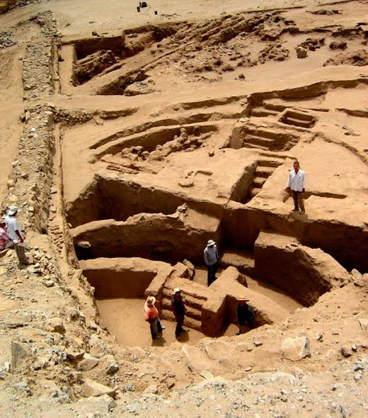
Archaeological Importance
Excavations throughout the Supe Valley have recovered numerous textile fragments, cotton fibers, spindle whorls, woven cords, fishing nets, and shicra bags, providing direct evidence of Caral's highly developed textile industry. These discoveries demonstrate that fiber technology preceded many other forms of material culture, including widespread pottery production.
The preservation of these ancient textiles has greatly expanded archaeologists' understanding of early Andean civilization. They reveal that technological innovation in Caral extended far beyond monumental architecture and included sophisticated knowledge of agriculture, engineering, commerce, administration, and craftsmanship. The civilization's achievements illustrate how a single natural resource—cotton—could support nearly every aspect of social and economic life.
Conclusion
The Caral-Supe Civilization's cotton textiles represent one of the earliest and most sophisticated examples of fiber technology in human history. Through the cultivation of naturally colored cotton, the development of advanced hand-weaving techniques, the production of durable fishing nets, the creation of earthquake-resistant shicra foundations, and the possible invention of early quipu-style recording systems, the people of Caral transformed textiles into the backbone of their civilization. Far more than simple fabrics, these woven creations supported architecture, agriculture, trade, administration, religion, and daily life, demonstrating extraordinary ingenuity more than 5,000 years ago. Today, Caral's textile legacy continues to highlight the technological brilliance of the earliest civilization in the Americas and provides invaluable insight into the origins of engineering, economic organization, and material culture in the ancient Andes.