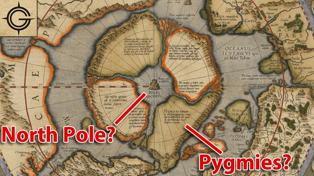
The Arctic has always been a region of fascination and mystery, and this 16th-century map adds another layer to its enigmatic allure. The depiction of four major land masses surrounding a polar sea, with a massive magnetic rock at its center known as Rupes Nigra, or the Black Rock, is both captivating and mysterious.
Maps from this era often combined cartographic knowledge with elements of folklore, mythology, and speculation, leading to the inclusion of fantastical elements such as mythical creatures, unexplored lands, and, apparently, magnetic anomalies like the Black Rock.
The mention of a massive magnetic rock hints at the early understanding of magnetic forces and their influence on navigation, a critical aspect of exploration during the Age of Discovery. The presence of such a landmark on the map underscores the challenges and dangers faced by explorers navigating the treacherous Arctic waters.
As we unravel the mysteries of this ancient map, we are reminded of the enduring human fascination with the unknown and the relentless quest for knowledge that drives exploration. It serves as a testament to the ingenuity and curiosity of early cartographers who sought to chart the uncharted and unlock the secrets of the world.

