
Long before a compass or naval maps were used in Europe, the Vikings set about sailing the high seas from modern-day Canada to Constantinople.
Vikings were skilled sailors and navigators. Source: vlastas / Shutterstock
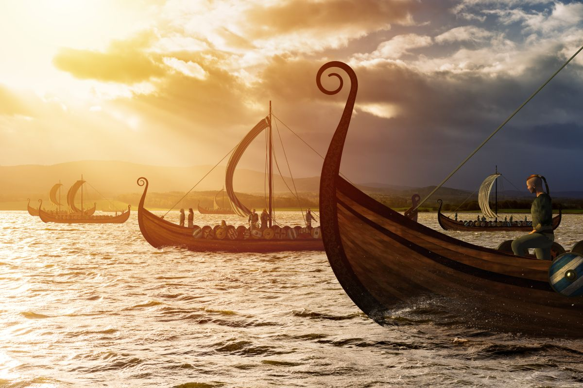
Their famous longships ferried them across meandering rivers, stormy seas, and expansive oceans, making them skilled sailors. Yet, without the aid of sophisticated naval technology, how did the Vikings navigate across such vast distances?
Water, water everywhere…
Deep love and knowledge of sailing are embedded into the fabric of modern Scandinavian societies. In Norway, for example, a nation of just over 5 million people, there is estimated to be over 1 million boats. So, where did this passion arise? One look at Scandinavia today, and you'll notice it is indeed girt by vast sums of water.
All the Nordic (Norway, Sweden, Finland, Iceland, Denmark, and Greenland) countries – where Viking societies were present during the early medieval period – are located in the northeast quadrant of the Atlantic Ocean. Zooming in further, there are a plethora of seas. These countries have the waters of the Baltic, the Barents, the Greenland, the Kattegat, the North, the Norwegian, and the Skagerrak seas wash up on their shores whilst having the frosty Arctic Ocean as a northern border.
The Vikings' skillful exploitation of nautical technology enabled them to raid, trade, and colonize throughout the Western Hemisphere and into North Africa and West Asia. Being surrounded by vast oceans and seas, it should be no surprise that the most iconic symbol of the Vikings is, after all, a ship.
Vikings possessed a wealth of rudimentary maritime navigation skills and knowledge
In an era before the compass had arrived in Europe, before maps were widespread and satellite navigation was a millennium away, the Vikings sailed vast distances between Northern and Southern Europe, throughout the Mediterranean Sea, through the vast and numerous river systems of Eastern Europe and the Russian steppe and across the North Atlantic Ocean.
They did, however, have some rudimentary navigational knowledge. Their knowledge of direction – North, South, East, and West – came from the daily cycle of the sun. Yet the principle underpinning much of their navigational skills was the exact location on the horizon where the sun rose and how high it reached during the day.
Sailors from Viking societies also used other natural landmarks when taking to the high seas. The sun, the moon, and the stars also provided an understanding of the direction to travel. However, the often-inclement weather found in the North Atlantic Ocean hampered this.
Hugging coastal areas and looking for specific landmarks – rocks, bays, or a hilltop – could aid navigation. This sort of coastal hugging and landmark spotting is best described in the discovery of 'Vinland' in Grælendinga saga (Saga of the Greenlanders). Here, Leif Eriksson followed the past directions of a previous lost voyage to Greenland that ended up in 'Vinland' – what is now believed to be Newfoundland, Canada. Eriksson hugged the shore until he found a bay that was accessible in which the Norse explorers went ashore to explore this strange new world.
Sun crystals - kooky pseudo-science or a historical fact?
A new and emerging theory in Norse studies – first proposed in 1967 by Danish archaeologist Thorkild Ramskou – was that Viking sailors used chunks of crystal, called sunstones, to track the sun on a cloudy day. However, there is some actual science – and not pseudo-science – behind the proposed use of crystals for navigation.
The use of a crystal to find the sun on a cloudy day relies on the 'polarization' of the sun. This means that the light had a specific orientation. When then sunlight travels through the atmosphere, it forms polarized rings. These rings are only visible for animals and fish as the human eye is unable to detect them. However, with the use of crystals, like calcite, the direction of polarization, even on a cloudy day, can be revealed. When the sunstone is at its brightest, the crystal will point at the sun, allowing some form of rudimentary navigation, even on a grey, wet, and miserable foggy day in the North Sea.
These sun crystals were often mentioned in stories and sagas. One such instance was the reference to a sólarsteinn (a solar stone, a sunstone) in The Saga of King Olav. Yet the only archaeological evidence of the use of solar stones was from almost half a millennium later. In 2013 a British team discovered a ship that had been sunk in 1592 – 500 years after the end of the 'Viking Age.' Amongst the items were shards of a crystal, an Iceland spar (calcite), that was believed to have been used as a sunstone.
The answer is right in front of your nose - and animal friends
Vikings also used their other senses to navigate the oceans, seas, and rivers across much of the Western hemisphere and beyond. Listening for birds and the crashing of waves on the shore was one way to figure out how close they were to land on a foggy day. The direction of a sea breeze could also be used to navigate as well as to determine whether any fresh water, from the land, had flowed around them. Finally, an experienced sailor can smell signs of land life – fires, trees, and even some plants – given suitable conditions.
Animals were also helpful friends when it came to maritime navigation. Spotting certain birds meant land was near as particular breeds only flew close to the shore. Whales usually stayed close to currents where plentiful fish could be found. The Vikings knew of the migratory habits of many whales and could use this to help find particular areas of oceans or seas.
Viking sailors masterfully employed all this knowledge, skill, and expertise, whether they were raiding, trading, or exploring the oceans around the Scandinavian peninsula and beyond. Surely they rate as some of the medieval era's best maritime navigators… after all, they "discovered" America half a millennium before Columbus…
The Royal Society published a study in 2018 looking at the Viking's use of solar stones and polarization. You can find it here.


