Greece opens to Public Three Underwater Archaeological Shipwreck Sites

The underwater archaeological sites that can be visited are the late Roman shipwreck at Telegrafo Nion Sourpis, the Byzantine shipwrecks at Glaros Nion and Kikynthos Amaliapolis.

The late Roman shipwreck at Akrotiri Glaros

The western part of the Cape of Glaros is scattered with anchors mainly from the Middle Byzantine period. A closer study of the concentrations and the condition of some, combined with the concentration of pottery, probably date to the wreck of a large merchant ship of the 12th-13th c. A.D. Its cargo consisted of amphorae carrying wine. The multitude and dispersion of pottery gives the impression of a large cargo and therefore a ship.

Depending on the route, the diving visitor can observe the evolution of anchor types from different eras, the history of the last moments of a shipwreck through its anchors, as well as the combination of the marine environment and the remains of the shipwreck.

Glaros, Western Pagasitic, Byzantine amphora body,

©YPPOA-EEA, photo Matteo Collina Univerità della Calabria –DIMEG

The Byzantine shipwreck in Kikynthos Amaliapolis

Between the 11th and 12th centuries at the entrance of the Pagasitic Gulf, a Byzantine merchant ship was wrecked near the islet of Kikynthos, located to the east of the bay of Amaliapoli. The bulk of the wreck consists of pithos and amphorae. Its location was identified by the Institute of Marine Archaeological Research in 2005.

Today, the diving visitor can observe the remaining fragments of pithos and some amphorae, which constitute the main concentration of the wreck.

Kikynthos, Western Pagasitic, pitho fragments,

©YPPOA-EEA, photo Matteo Collina Univerità della Calabria –DIMEG

The Byzantine shipwreck at Akrotiri Telegrafos

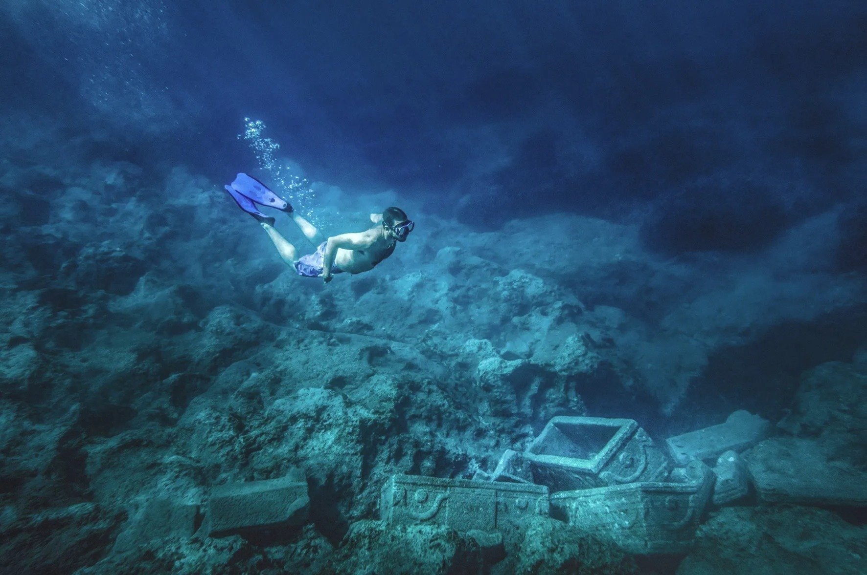
At the bottom of the northeastern shore of Cape Telegrafos are the remains of a ship's cargo from the late Roman period. Its cargo consisted exclusively of trade amphorae. The excavation and study of the amphorae showed that they were carrying wine, garum (a fermented fish sauce which was used as a condiment), fruit and olives, with the main origin of mainland Greece and the Eastern Aegean.

View of Telegrafo’s shipwreck

©YPPOA-EEA, photo Stefanos Kontos

The ship's destination would be one of the ports of the Pagasitic Gulf, to exchange its cargo for grain. Most likely, a rough sea overturned the ship and its cargo was lost at the bottom until it was "recovered" by the research of the Institute of Marine Archaeological Research. The visiting diver can observe the site and the traces of the underwater excavation, where part of the scattered cargo is preserved.

Wreck cargo collection area 9 in Kikynthos. Sections of pithos and amphorae can be distinguished

©YPPOA-EEA, photo Stefanos Kontos

At the Public Information and Awareness Center for the three Visitable Underwater Archaeological Sites, the visitor can have the experience of virtual diving with 3D augmented reality glasses. Thanks to the virtual tour the underwater world of the three wrecks becomes universally accessible, even to those who cannot do natural diving.

View of Telegrafo’s shipwreck

©YPPOA-EEA, photo Stefanos Kontos

The three new underwater archaeological sites, together with the underwater archaeological site of Alonissos, make up a unique underwater archaeological park with a unique diving experience at an international level.

Thessaloniki, Greece: An Entire Underground Ancient City was found During Metro Construction

Impressive are the photos of the finds brought to light by the archaeological shovel in Thessaloniki, Greece's 2nd biggest city, during the construction of the local metro facilities.

In 2012, during the excavations carried out at the "Amaksostasio" of the main line of the Metro, in Pylaia, a pre-Cassandrian small town of the 4th century BC came to light. An area of ​​31 acres was investigated and part of the city was revealed, which was organized with the Hippodamian urban planning system, following the standards of the great cities of Macedonia, Olynthos and Pella.

The numerous finds point to a prosperous settlement with a strong economy and developed socio-political structures. Its great development is placed in the second half of the 4th century. BC, which was however interrupted by the founding of the city of Thessaloniki by Kassandros in 315 BC, when it was abandoned.

Another interesting find is the cemetery of Roman times (2nd -4th century AD) that was investigated in the limits of the Fleming Station and revealed to us aspects of a hitherto unknown settlement, on the outskirts of ancient Thessaloniki.

During the construction works of Thessaloniki METRO, at the stations near Aristoteleion University, the archaeological research revealed a large part of the eastern cemetery of the city, as well as a three-kilometer cemetery Basilica with mosaic floors on the site of an older building. In particular, it brought to light thousands of funerary monuments (3000) which have come to enrich our knowledge so far about the organization and continuous use of the space from the Hellenistic period to Late Antiquity.

The tombs belong to various types, pit-shaped, box-shaped, pot burials, altars, altar-shaped constructions, single or double vaulted, decorated with clay and glass vessels, clay figurines, gold and silver jewelry and coins.

The excavations carried out at the two stations within the historical center of Thessaloniki, the Agia Sophia Station and the Venizelos Station, complete the topographical map of the city, at the level of the main thoroughfare, today's Egnatias Street. The findings outline the urban planning organization of the urban space of Thessaloniki from its foundation to the end of late antiquity.

The city was designed in its lowland parts with the Hippodamian urban planning system. Streets, perpendicular to each other, form building islands with residential and laboratory buildings.

The same design is preserved in Roman times, with small-scale alterations to the building plan. In the 4th c. A.D. the now marble-paved streets are flanked by colonnaded arcades and on either side of them are erected large building complexes with luxurious mosaic floors, wall written decoration, marble cladding and opus sectile. At the same time, to the north of the decumanus, at the junction with the cardo of the Agia Sophia street, a cistern building/nymphaeum was constructed that shows overlapping building phases. A drastic intervention in the urban planning of the city takes place in the 6th century: the marble-paved decumanus is widened, the older buildings are leveled and in their place paved squares are formed at the central crossroads of the city.

Those imposing architectural configurations of the public space - squares, arcades and fountains/nymphaea - along the central streets are the last monumental image of late antiquity.

The excavation research in the two stations of the historical center of Thessaloniki revealed parts of the Byzantine market along the main street, the so-called Avenue or Middle of the Byzantines.

The central cobbled street of Byzantine times was revealed, in the trace of the older decumanus maximus with an average width of 5.5 to 6.5m. New roads with a straight, winding and diagonal course are drawn or existing ones change their course, simultaneously defining the extent of the building islands. The islands of mud-built buildings occupied the public space, the sidewalks and the arcades of late antiquity. These are workshops and shops of a market where jewelry, articles of metalwork, glasswork, ceramics, etc. are produced. Brick constructions, kilns, work benches, together with tools, jewelry making molds, unfinished ceramics, tripods, attest to the productive use of the premises throughout the Byzantine period.

During the Ottoman period, the urban planning changes do not seem to be radical. After all, the building remains were found disturbed by the basements of the buildings of more recent times.

The upper layer found at both stations provided evidence for the urban planning organization of Thessaloniki during the last period of the Turkish occupation (second half of the 19th century CE). marked by urban changes aimed at creating a city designed according to European standards. The buildings they excavated, mainly underground, were found destroyed by the fire of 1917 that burned down the center of Thessaloniki and was the springboard for the design of the modern city.

The stations in the west city are located in the countryside outside the old walls of Thessaloniki. The excavation research carried out in sections by periods, during the years 2009 – 2012, 2016 -2017, when it was completed, supplemented our knowledge over time from the 3rd c. BC until recent times for the spatial development of the peri-urban western zone.

The spatial organization of the area was dictated by two parameters: the passage of the main road, the well-known Roman Egnatia road that connected Thessaloniki with Pella, and the flowing streams. Overlapping gravel and earthen pavements of the road, which reached outside the Golden Gate crossing the Keramisious plain and the cemetery, were located under today's Monastiriou Street.

At the New Railway Station is a bypass and developed along the northern side of this road axis. Organized into clusters it includes a variety of tombs and altar-like structures - usually within burial enclosures, providing spaces for funerary ceremonies and offerings. Marble sarcophagi and luxurious burial buildings of the 2nd, 3rd and 4th c. AD stand out.

The period of use of the necropolis covers a long period from the 3rd century BC. up to the middle of the 4th c. AD, when Christian cemeteries are organized around cores with religious buildings, temples and martyrdoms. Later, and mainly from the 6th c. A.D. sporadic burials continue. which do not constitute an organized cemetery.

The excavation at the station and the entrances of the Democracy Square, on the outskirts of the necropolis, just a few meters outside the western walls, brought to light on either side of the road that led from the countryside to the Golden Gate, large complexes of state wine and oil warehouses (pytheon ) and laboratories of late antiquity.

On the ruins of the python, it was founded in the 5th century a square temple with a funerary addition, storerooms and workshops. At the end of the 6th c. – beginning of the 7th c. the temple and its facilities are completely destroyed and abandoned. Among its hallowed ruins are sporadic burials. Building activity is limited to the south. In the following centuries the area remained undeveloped, not by chance, after all, it was called by the Ottomans Ҫayir, i.e. Meadow or Meadow. As soon as the late 19th c. will regain its commercial character, when inns, shops and warehouses are built on the axis of Monastiriou Avenue.

Constantinople's Byzantine Basilica Cistern reopens after 5 years of Restoration Works (Photo Gallery)

The Byzantine Basilica Cistern, one of Constantinople's (Istanbul) most historical buildings, was reopened to visitors with the completion of the restoration process that started in 2017. In addition to the earthquake strengthening works, the lighting was also overhauled in the museum.

The Basilica Cistern or Cisterna of Illus (Greek kinsterne=κινστέρνη), now known as Yerebatan Saray (Turkish: underground palace) or Yerebatan Sarnıcı (Turkish: underground tank) is the largest underground water tank built in Istanbul, measuring approximately 141 × 66.5 m in plan and with a capacity of 78,000 m3. It is located on the first hill of the city, about 150 meters southwest of Hagia Sophia, in the Sultanahmet area of ​​the historic center.

The Basilica Cistern impresses visitors with its 336 columns, each 9 meters tall, and two Medusa heads. The columns are mostly cylindrical and made out of a single block. The two Medusa heads, two great examples of Roman era architecture, garners a lot of attention. Both work as the bases for two of the 336 columns located on the northwest side of the cistern. They are thought to have been brought to be used as supports for the columns at the time of construction of the cistern.

An interior view of the Basilica Cistern Museum, Istanbul, Turkey, July 22, 2022. (IHA Photo)

It was named so because of its position, below the Stoa Basilica which was west of Augustaion. The Stoa was probably built by Constantine the Great but was destroyed around 475. The cistern was shaped as it is today, when it was rebuilt around 542 by Emperor Justinian I, after the period of the Nika Riots, to supply water to Constantinople throughout the Byzantine period and to supply water to the adjacent Great Palace, where the Byzantine emperor had his seat.

It was one of Justinian's most important public works and an excellent example of Byzantine engineering. The Greek historian Procopius of Caesarea gives a detailed description of the cistern in his work ‘the Buildings’, noting that fresh water was brought into it by means of a conduit, while a quantity of water was also stored there, which was usually abundant in seasons other than summer.

After the conquest of the city by the Ottomans, knowledge of the cistern seems to have been lost, but it was later discovered by Pierre Gilles (or Petrus Gyllius, 1490 - 1555) during his tour of Constantinople in the mid-16th century. Gilles describes how the residents had no knowledge of the reservoir's existence, despite the fact that they pumped water and caught fish by throwing buckets into the basements of their houses.

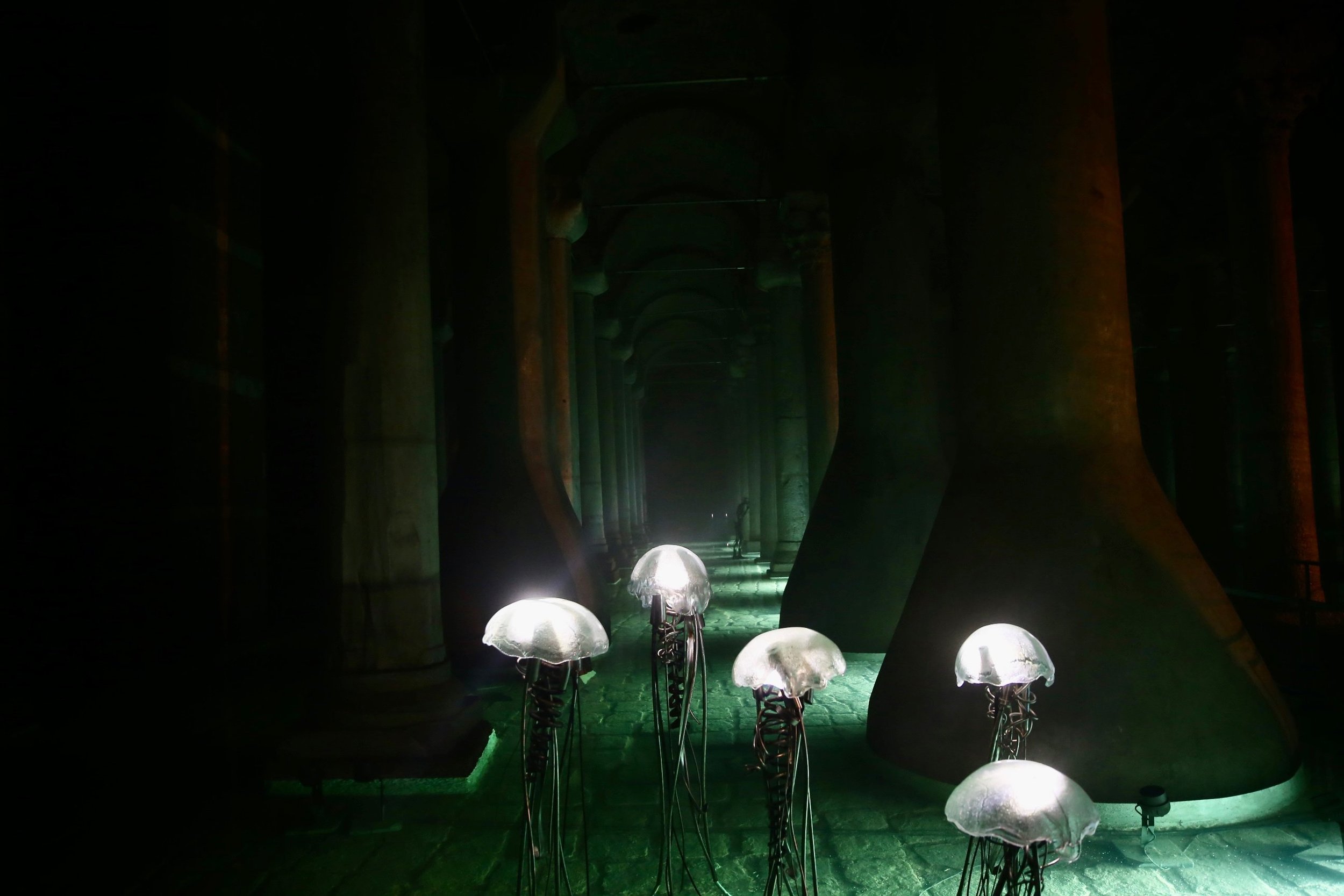
A view from the light-themed exhibition at the Basilica Cistern Museum, Istanbul, Turkey, July 22, 2022. (AA Photo)

After the Fall of Constantinople, the water from the Royal Cistern was used to irrigate the gardens at the Topkapi Palace (Topkapi Sarayi). From the 18th to the middle of the 20th century, restoration works were carried out to preserve the cistern, which, after a renovation that began in 1985, had been open to the general public since 1987 and is one of the most important and oldest public spaces. Musical concerts are given in its space with excellent acoustics.

photos by AFP/IHA/AA

As part of the restoration, launched in 2017, the ties fixing the columns to each other were renewed to prepare the construction for a possible earthquake. The entrance hall of the cistern was also redesigned while the lighting was renovated. The cistern now hosts visitors with an exhibition themed "light."

The Basilica Cistern Museum can be visited between 9 a.m. and 5 p.m.

Istanbul: New vandalism in Hagia Sophia

Since the conversion of the once Christian Cathedral into a Mosque, it has been vandalised many times

Turkish TV Network “aTV” has reported that the Hagia Sophia has suffered vandalism anew, saying that the UNESCO structure has become a “target of the uncivilised”. After the destruction of the imperial gate, the walls and the marbles, the metal plates (emblems ), which adorn the main entrance were the latest focus of the vandals.

“Once again Hagia Sophia became the target of the uneducated. You will remember that in the past they caused damage to the imperial gate, the walls, and the marbles. So, now one of the emblems on the door of Hagia Sophia has disappeared. First, it was the imperial gate, then the walls and marbles, and now the emblems. Every side of Hagia Sophia is sacred and that’s probably why someone considered it sacred and took it home” said the “aTV” reportage (video).

“We are next to the imperial gate which is one of the most important points of Hagia Sophia. Right next to the gate is a very sad picture. See there are many emblems but one of them does not exist at the moment. Either it was stolen or it disappeared,” says the journalist, pointing to the spot at the main gate through which hundreds of people pass every day.

A citizen also spoke in the reportage, stating that he is disappointed by the vandalism that has taken place at the monument recently: “It really saddens me to see Hagia Sophia in this state. A series of unpleasant events happened to its detriment. I see no end to this,” he said.

Last June the use of a floor cleaning machine, used inside the monument, resulted in a breakage of the marble floor.

Closure
Exactly two years after Hagia Sophia was reopened as a Muslim mosque by President Tayyip Erdogan, vandalism and destruction continue at the UNESCO-listed monument.

Source: Greece High Definition

Gümüşler Monastery: An Abandoned Byzantine-era Cave Monastery in Cappadocia

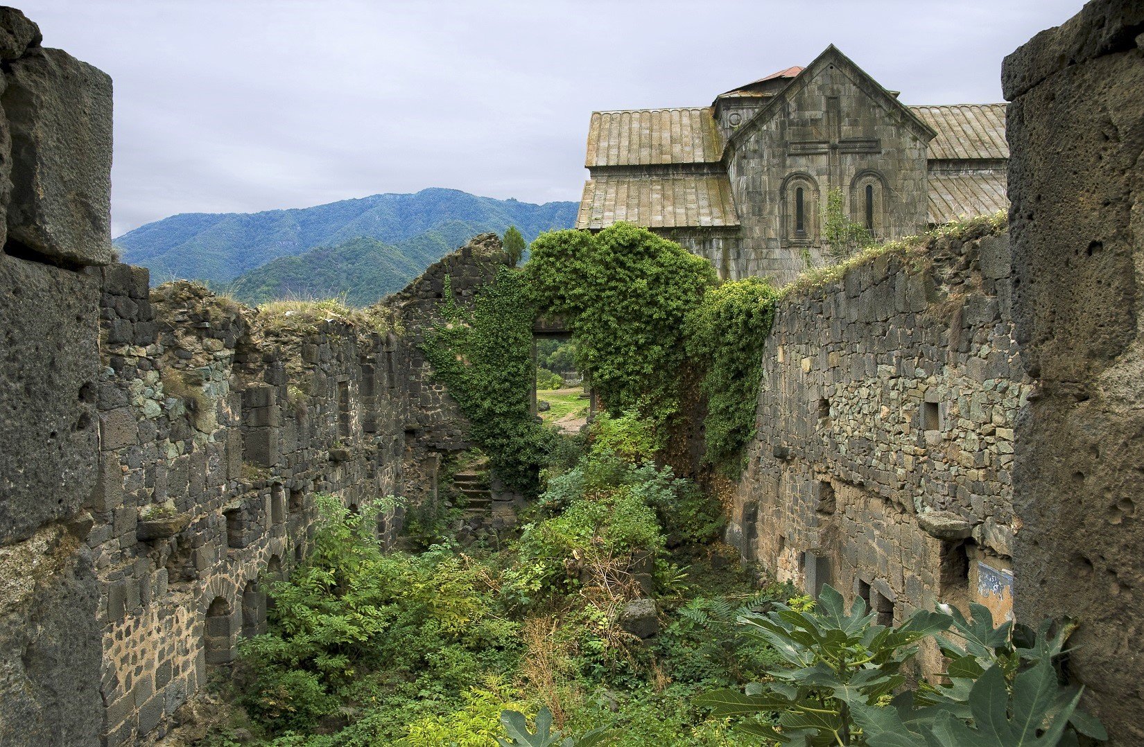
Gümüşler Monastery is a Byzantine-era cave monastery in the town of Gümüşler, Niğde Province, modern Turkey.

The monastery is carved out of a large rock and is one of the best preserved and largest of its kind in the Cappadocia region. There are quite a few monasteries hewn out of the rock in Cappadocia and some scholars split these into two types: those with dining halls and those with open courtyards. The Gümüşler Monastery is part of the second group.

The most important part of the monastery complex is the church to its north. The church comprises four freestanding closed aisles based on the Greek cross plan; in the northern aisle of the cross there is a niche with two tombs. To the west there are two entrances covered with a cradle vault.

It is assumed that at least three different masters worked on the paintings found on the walls of the church. In the main apse there are three bands of paintings: the highest shows Christ Enthroned with two angels to his right, the symbols of the gospel writers and the moment of Deisis with Mary and the disciples. The lowest series shows fathers of the church, Basil the Great of Kayseri, Gregory of Nisa, and Gregory of Nazians.

In the north aisle of the cross are representations of The Annunciation, The Nativity and The Presentation at the temple with the figures of John the Baptist and Saint Stephen which must have been painted by the hand of a second artist. On the inside of the narthex to the south of the entrance door are representations of Mary and baby Jesus and on each side of them the archangels Gabriel and Michael which belong to the hand of a third artist.

On the walls of room above the narthex is an example of something not seen anywhere else in Cappadocia: hunting scenes. There is an interesting composition of a variety of animals. The special style and iconography of the paintings on the walls of the Gümüşler Monastery is the same as what can be seen in many churches in Cappadocia. It is possible to date the paintings in the church to the 12th and 13th century A.D. by comparing and evaluating them by these traits.

1,800-Year-old Iron Roman Mask Found in the Ancient City of Karabük

A 1,800-year-old iron mask thought to belong to a Roman soldier was found in the Hadrianaupolis Ancient City in Karabük.

Excavations in the Hadrianaupolis Ancient City, located in the Eskipazar district of Karabük, Turkey have been continuing since 2003. The excavations in the ancient city of Hadrianaupolis, which is estimated to have been used from the 1st century BC to the 8th century AD in the village of Budaklar, were carried out by Karabük University Archeology Department Lecturer Assoc. Dr. It continues under the chairmanship of Ersin Çelikbaş.

In the ancient city, where excavations continue for 12 months of the year, this season, the focus has been on a square planned structure whose function has not been resolved yet. From the fortification wall in the building been in question, it is estimated that this was a military building. An iron mask was unearthed during the work done inside the structure.

Stating that the history of the inner regions of the Western Black Sea Region has not been fully clarified yet, the head of the excavation, Assoc. Dr. Çelikbaş said, “We continue to illuminate the history of the region with our works. During our excavations, we found important data showing the existence of the Roman Empire in the region. This mask also belongs to a Roman soldier. A Roman cavalry face mask, a piece of helmet.” says.

Fragment of a Roman soldier's helmet.

Stating that there could be a Roman garrison and a military base in Hadrianaupolis, Çelikbaş said, “Rome has planned to make its defense at the far end by building bases against all kinds of dangers that may come from the Black Sea Region to its own geography. We think that one of these defensive military cities was Hadrianaupolis. The mask fragment is from the imperial period. It most likely belongs to the 3rd century when we look at similar examples and stratification history.” says.

During the excavations carried out in the southern necropolis of the ancient city last October, an iron ring dating back 1,800 years was found inside the rock tombs. On the agate stone on the ring, it was determined that the character of Pan, known as the god of shepherds in Greek mythology, was carved in very small sizes.

The movable ones from the findings obtained during the studies in the ancient city of Hadrianaupolis are taken to the museums in the surrounding provinces, while the immovables are preserved in their place.

Posted by Archaeophilia

Source: https://arkeofili.com/karabukteki-antik-ke...